Cooks_Karte_von_Neufundland.jpg

Size of this preview:
615 × 599 pixels
.
Other resolutions:
246 × 240 pixels
|
492 × 480 pixels
|
788 × 768 pixels
|
1,051 × 1,024 pixels
|
1,500 × 1,462 pixels
.
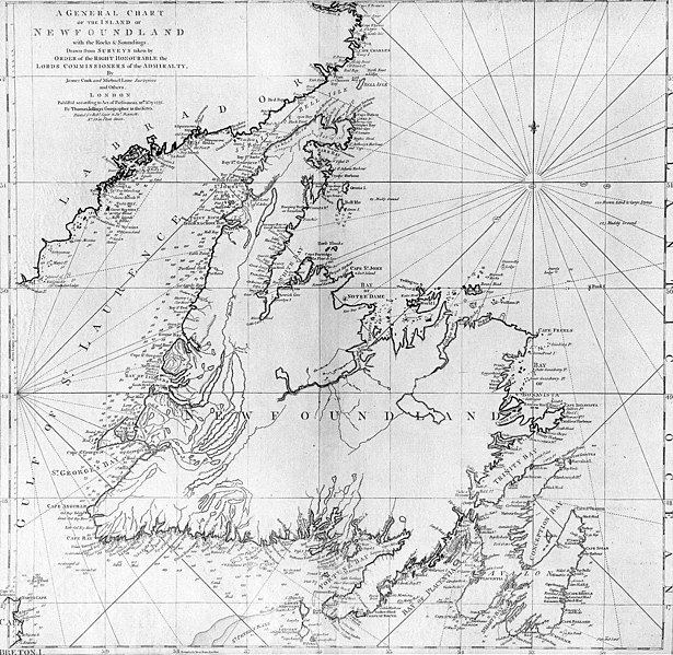
| Description | A general chart of the island of Newfoundland . Surveyed by James Cook and Michael Lane , and "publish'd according to Act of Parliament by Thomas Jefferys Geographer to the King, 1775." |
| Date | |
| Source | originally uploaded to en.wikipedia by Jcmurphy on 23 Apr 2005; copied from "Courtesy of the Centre for Newfoundland Studies, Memorial University of Newfoundland, St. John's, Newfoundland." |
| Author | Michael Lane and James Cook |
|
Permission
( Reusing this file ) |
Public domain because of age |
|
|
This work is in the public domain in its country of origin and other countries and areas where the copyright term is the author's life plus 100 years or fewer . |
| This file has been identified as being free of known restrictions under copyright law, including all related and neighboring rights. | |