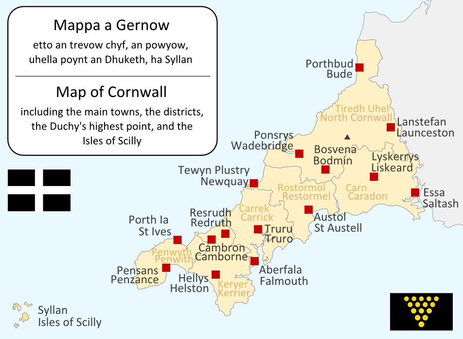
I made this map myself in September 2004. It is bilingual in Cornish and English, and shows the modern-day administrative boundaries of Cornwall and the larger towns.
QuartierLatin1968
17:36, 14 Apr 2005 (UTC)
Permission is granted to copy, distribute and/or modify this document under the terms of the
GNU Free Documentation License
, Version 1.2 or any later version published by the
Free Software Foundation
; with no Invariant Sections, no Front-Cover Texts, and no Back-Cover Texts. A copy of the license is included in the section entitled
GNU Free Documentation License
.
http://www.gnu.org/copyleft/fdl.html
GFDL
GNU Free Documentation License
true
true
to share
– to copy, distribute and transmit the work
to remix
– to adapt the work
Under the following conditions:
attribution
– You must give appropriate credit, provide a link to the license, and indicate if changes were made. You may do so in any reasonable manner, but not in any way that suggests the licensor endorses you or your use.
share alike
– If you remix, transform, or build upon the material, you must distribute your contributions under the
same or compatible license
as the original.
This licensing tag was added to this file as part of the GFDL
licensing update
.
http://creativecommons.org/licenses/by-sa/3.0/
CC BY-SA 3.0
Creative Commons Attribution-Share Alike 3.0
true
true
