Costantino_nord-limes_png.PNG

Size of this preview:
800 × 461 pixels
.
Other resolutions:
320 × 184 pixels
|
640 × 369 pixels
|
1,024 × 590 pixels
|
1,280 × 737 pixels
|
2,660 × 1,532 pixels
.
Summary
| Description |
English:
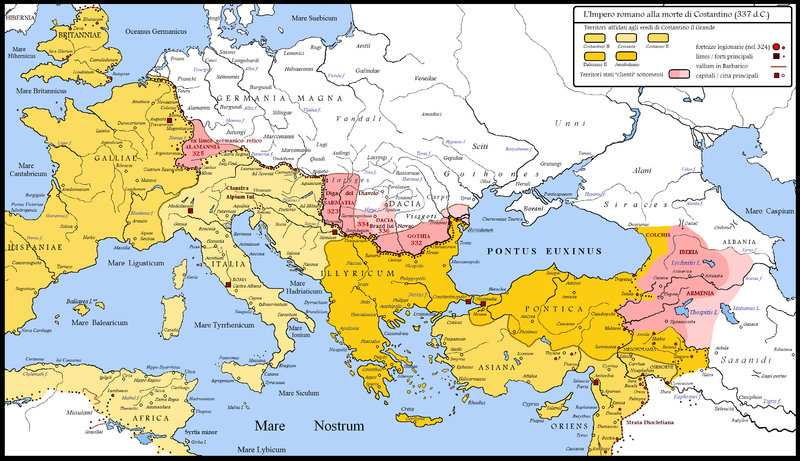
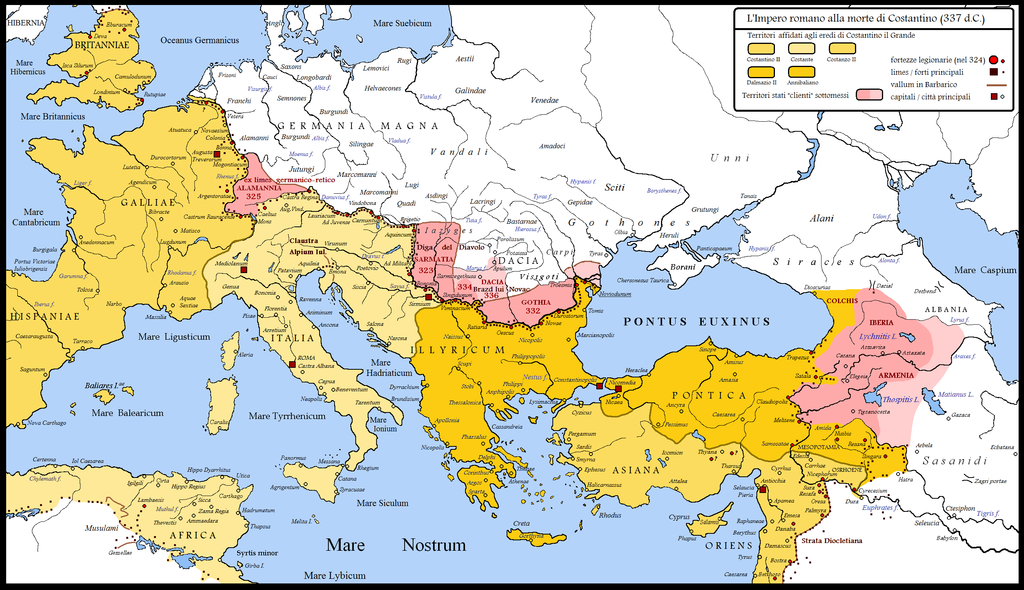
Roman World at the time of Constantine the Great
Italiano:
Il mondo romano al tempo di Costantino il Grande
|
| Date | |
| Source | Own work |
| Author | Cristiano64 |
Licensing
I, the copyright holder of this work, hereby publish it under the following licenses:
This file is licensed under the
Creative Commons
Attribution-Share Alike 3.0 Unported
license.
-
You are free:
- to share – to copy, distribute and transmit the work
- to remix – to adapt the work
-
Under the following conditions:
- attribution – You must give appropriate credit, provide a link to the license, and indicate if changes were made. You may do so in any reasonable manner, but not in any way that suggests the licensor endorses you or your use.
- share alike – If you remix, transform, or build upon the material, you must distribute your contributions under the same or compatible license as the original.

|
Permission is granted to copy, distribute and/or modify this document under the terms of the GNU Free Documentation License , Version 1.2 or any later version published by the Free Software Foundation ; with no Invariant Sections, no Front-Cover Texts, and no Back-Cover Texts. A copy of the license is included in the section entitled GNU Free Documentation License . |
You may select the license of your choice.
Nisibis
Nisibis is not correctly situed in the map of Roman Empire 337. Seems that position of Nisibis and Resina are inverted, probably a small mistake while creating the vector or bitmap file. The map is, in my humble opinion, very accurate and the best available at less in the web. Jaume Ollé