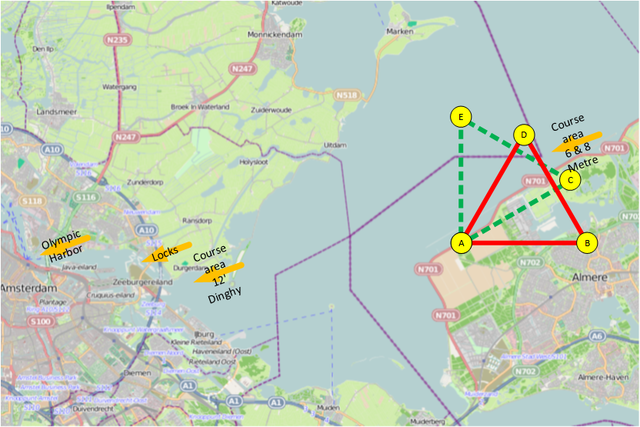
Course_area_6_&_8_Metre_1928.png

Size of this preview:
800 × 534 pixels
.
Other resolutions:
320 × 213 pixels
|
640 × 427 pixels
|
832 × 555 pixels
.
| Description |
English:
Open street map view of the current map of The Netherlands Projected are the 1928 Olympic courses of the 6 & 8 Metre.
|
| Date | (see file history) |
| Source | You may find a page on the OpenStreetMap wiki page for IJsselmeer, The Netherlands |
| Creator |
OpenStreetMap contributors and
VYGOcommons
OpenStreetMap contributors
|
|
Permission
( Reusing this file ) |
OpenStreetMap data and maps are licensed under the
Creative Commons
Attribution-ShareAlike 2.0 license (CC-BY-SA 2.0).
This file is licensed under the
Creative Commons
Attribution-Share Alike 2.0 Generic
license.
|
| Georeferencing | If inappropriate please set warp_status = skip to hide. |
| Camera location |
|
View this and other nearby images on: OpenStreetMap |
|
|---|