Crac_des_chevaliers_syria.jpeg
Size of this preview:
800 × 312 pixels
.
Other resolutions:
320 × 125 pixels
|
640 × 250 pixels
|
1,024 × 399 pixels
|
1,280 × 499 pixels
|
4,015 × 1,566 pixels
.
Summary
| Description |
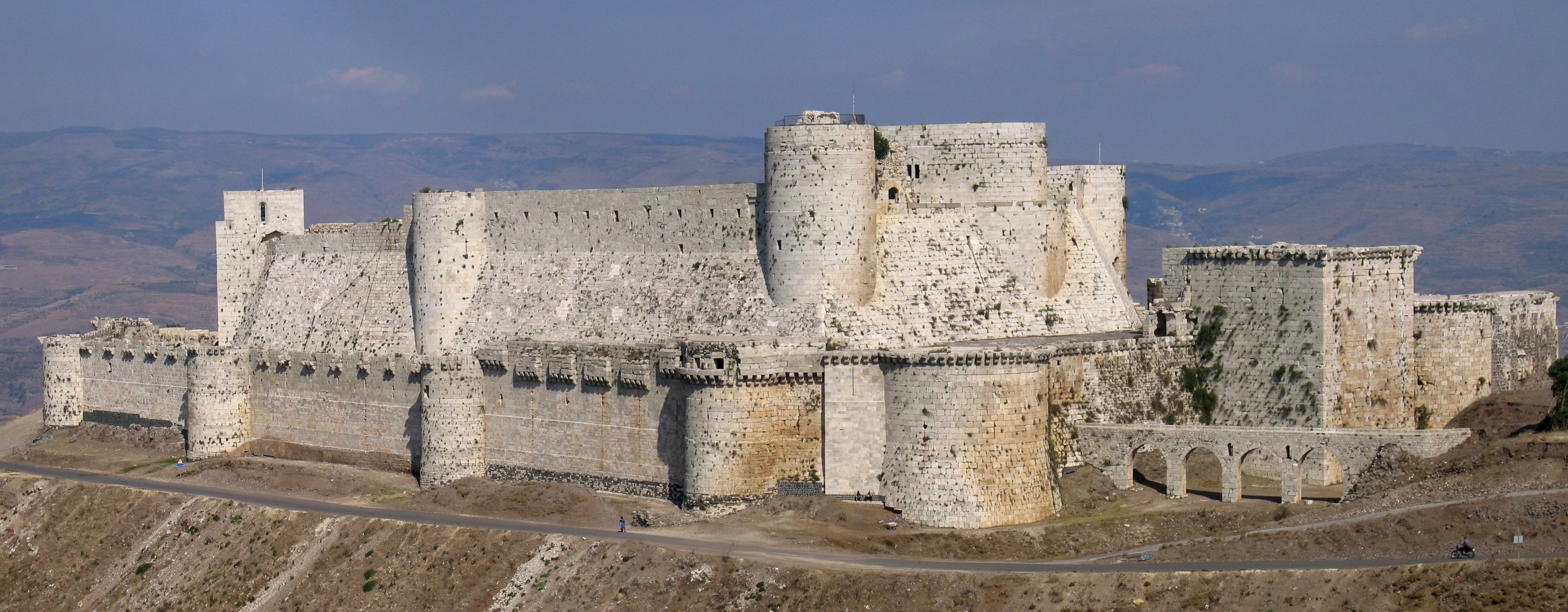
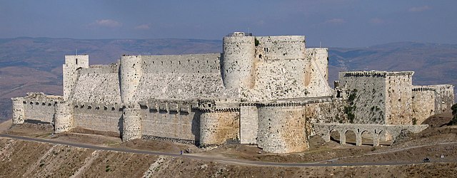
English:
Krak des Chevaliers
in Syria, built during the crusades for the Knights Hospitallers
Français :
Le
Krak des Chevaliers
, en Syrie.
|
| Date | |
| Source |
Own work
Barber, Malcolm (2004) The Two Cities: Medieval Europe 1050–1320 (Second ed.), Routledge, p. 361 ISBN : 978-0-415-17415-2 . Boas, Adrian J. (1999) Crusader Archaeology: The Material Culture of the Latin East , Routledge, pp. 112–113 ISBN : 978-0-415-17361-2 . |
| Author | Xvlun |
| Camera location |
|
View this and other nearby images on: OpenStreetMap |
|
|---|
Licensing
I, the copyright holder of this work, hereby publish it under the following license:
This file is licensed under the
Creative Commons
Attribution-Share Alike 2.5 Generic
license.
-
You are free:
- to share – to copy, distribute and transmit the work
- to remix – to adapt the work
-
Under the following conditions:
- attribution – You must give appropriate credit, provide a link to the license, and indicate if changes were made. You may do so in any reasonable manner, but not in any way that suggests the licensor endorses you or your use.
- share alike – If you remix, transform, or build upon the material, you must distribute your contributions under the same or compatible license as the original.
Assessment

|
This image has been assessed under the valued image criteria and is considered the most valued image on Commons within the scope: Krak des Chevaliers . You can see its nomination here . |