Crich_Stand2.jpg
Size of this preview:
800 × 536 pixels
.
Other resolutions:
320 × 214 pixels
|
640 × 428 pixels
|
1,024 × 685 pixels
|
1,280 × 857 pixels
|
2,560 × 1,714 pixels
|
3,872 × 2,592 pixels
.
Summary
| Description |
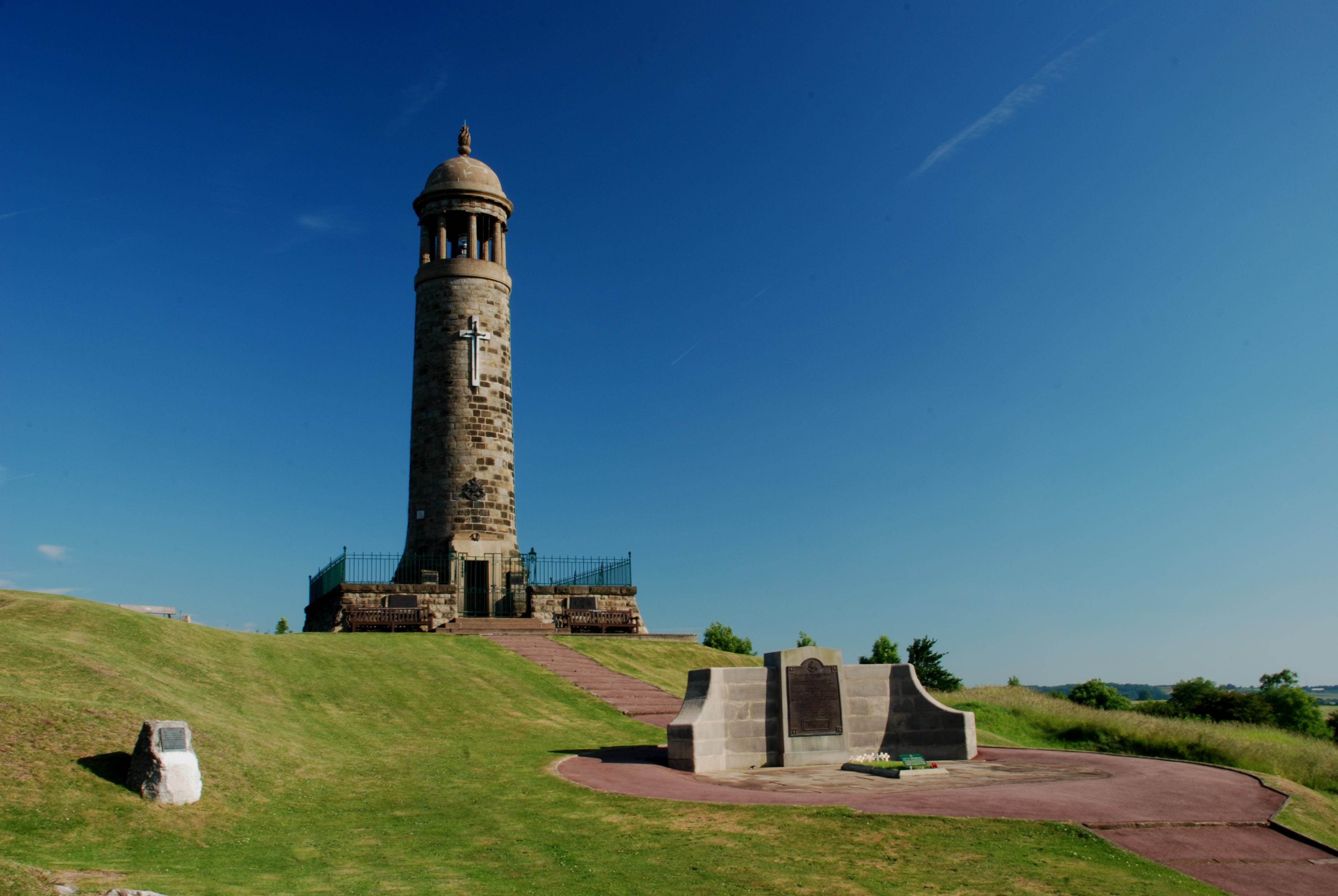
English:
The Memorial Tower ('Crich Stand') in
Crich
,
Derbyshire
, completed in 1923. The large plaque in the foreground dedicates the tower to the memory of the soldiers from the
Sherwood Foresters Regiment
who died in
World War I
and
World War II
. Two further plaques are found beneath the railings, either side of the door. One further dedicates the memorial to those who died serving in the Sherwood Foresters regiment from 1945 to 1970, while the other further dedicates it to those who died serving the
Worcestershire and Sherwood Foresters Regiment
from 1970 to 2007 and the
Mercian Regiment
since 2007. The small plaque to the left is dedicated to Brigadier J.H.M. Hackett,
'Last Colonel The Sherwood Foresters 1965 - 1970 and First Colonel The Worcestershire and Sherwood Foresters Regiment'.
|
| Date | |
| Source |
I (Rob Bendall / Highfields ) created this work entirely by myself. More information...Transferred from en.wikipedia by User:Common Good using CommonsHelper . |
| Author | Rob Bendall ( Highfields ) |
|
Permission
( Reusing this file ) |
ATTRIBUTION. |
| Object location |
|
View this and other nearby images on: OpenStreetMap |
|
|---|
Licensing

|
The copyright holder of this file, Rob Bendall , allows anyone to use it for any purpose, provided that the copyright holder is properly attributed. Redistribution, derivative work, commercial use, and all other use is permitted. |
|
Attribution:
Rob Bendall
(For more information, see my userpage ...)
|
Original upload log
The original description page was
here
. All following user names refer to en.wikipedia.
- 2011-07-06 14:42 Highfields 3872×2592× (510241 bytes) same image, better quality
- 2009-07-10 10:34 Highfields 700×468× (72537 bytes) {{Information |Description = [[Crich|Crich Stand]], [[Derbyshire]] |Source = I created this work entirely by myself. |Date = 31th June 2009 |Author = Rob Bendall (<font face="Batik Regular">''[[User:Highfields|Highfields]]