Dardanelles_map2.png
No higher resolution available.

|
This
map
image could be re-created
using
vector graphics
as an
SVG
file
. This has several advantages; see
Commons:Media for cleanup
for more information. If an SVG form of this image is available, please upload it and afterwards replace this template with
{{

vector version available

|

new image name

}}
.
It is recommended to name the SVG file “Dardanelles map2.svg”—then the template Vector version available (or Vva ) does not need the new image name parameter. |
Summary
Español:
Estrecho de los Dardanelos
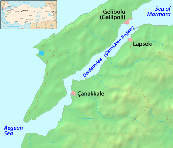
Map of the Dardanelles. Modified version of Image:Dardanelles map.png
Image history of en:Image:Dardanelles map2.png :
(del) (cur) 23:48, 25 September 2005 . . ChrisO . . 700x600 (125686 bytes) (Amended version of :Image:Dardanelles map.png {{PD}})
|
|
This work has been released into the
public domain
by its author,
ChrisO
, at the
English Wikipedia
project
. This applies worldwide.
In case this is not legally possible:
|