Dead-Sea---Salt-Evaporation-Ponds.jpg
Size of this preview:
525 × 599 pixels
.
Other resolutions:
210 × 240 pixels
|
421 × 480 pixels
|
673 × 768 pixels
|
1,057 × 1,206 pixels
.
Summary
| Description |
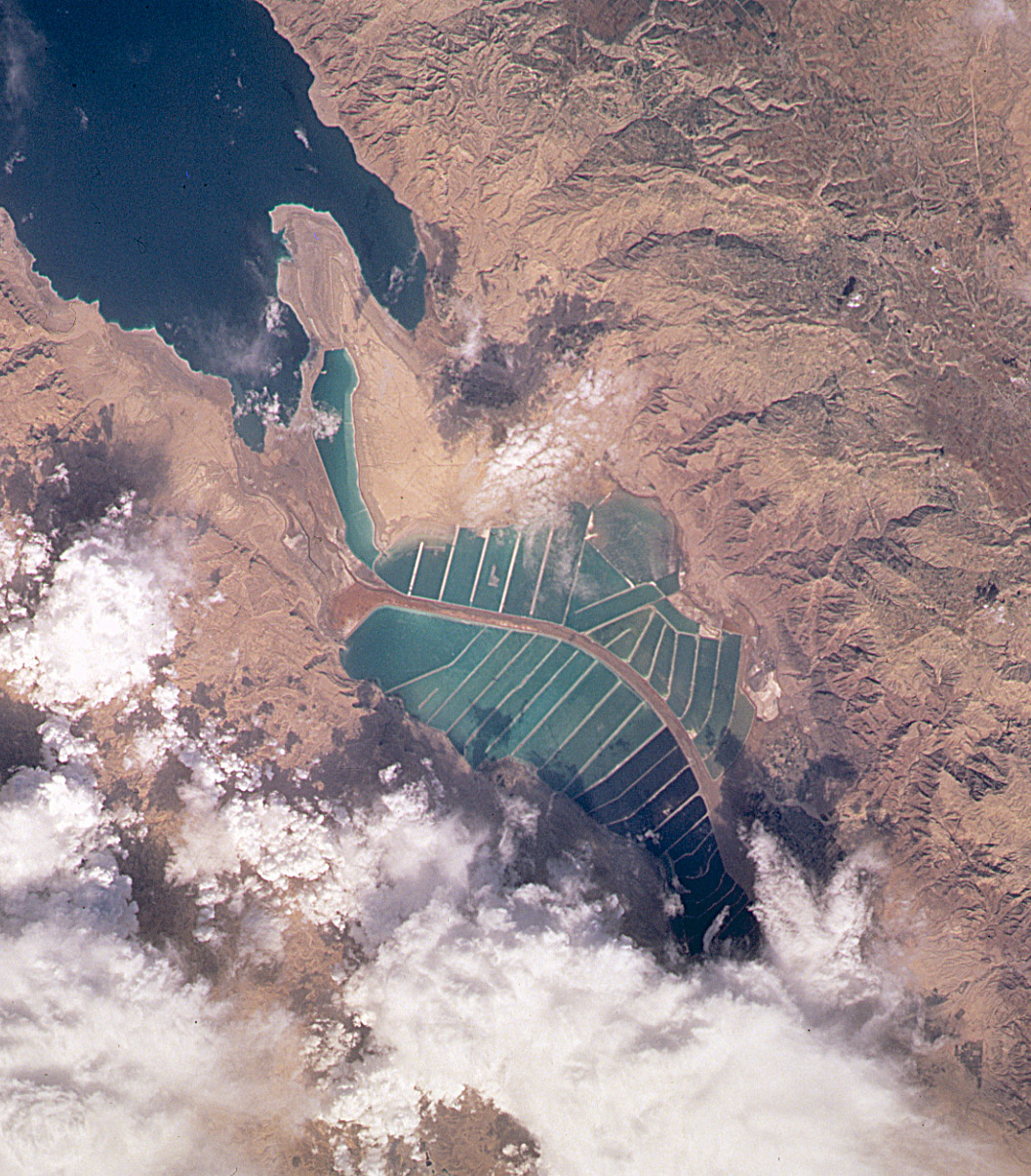
English:
Orbital image of
Jordanian
and
Israeli
mineral evaporation ponds
at the south end of the
Dead Sea
, separated by a central dike that runs roughly north-south along the international border.
|
| Source | http://visibleearth.nasa.gov/cgi-bin/viewrecord?7875 |
| Author | Image taken from the space shuttle by the STS102 crew in March 2001. |
Captioned As
| Page | Caption |
|---|---|
| Dead Sea | View of the mineral evaporation ponds almost 12 years later ( STS-102 ). A northern and small southeastern extension were added and the large polygonal ponds subdivided. |
Licensing
|
|
This file is in the public domain in the United States because it was solely created by NASA . NASA copyright policy states that "NASA material is not protected by copyright unless noted ". (See Template:PD-USGov , NASA copyright policy page or JPL Image Use Policy .) |
|

|
Warnings:
|
Original upload log
The original description page was
here
. All following user names refer to en.wikipedia.
| Date/Time | Dimensions | User | Comment |
|---|---|---|---|
| 2004-10-10 19:45 | 1057×1206× (530534 bytes) | Solipsist | Satelite image of [[Jordan]]ian salt evaporation ponds at the south end of the [[Dead Sea]] |