Dead_Vlei_4.jpg

Size of this preview:
800 × 533 pixels
.
Other resolutions:
320 × 213 pixels
|
640 × 427 pixels
|
1,024 × 683 pixels
|
1,280 × 853 pixels
|
2,560 × 1,707 pixels
|
3,787 × 2,525 pixels
.
|

|
|
This image was selected as
picture of the day
on Wikimedia Commons for
29 September 2010
. It was captioned as follows:
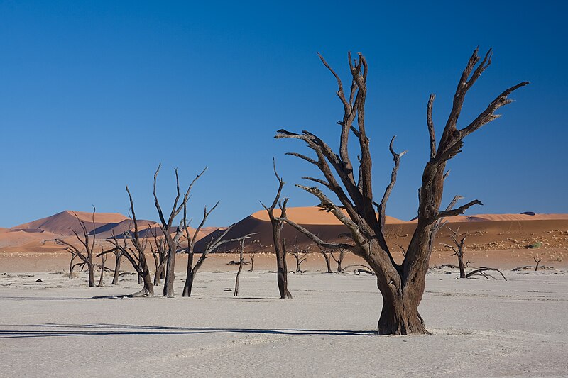
English:
Dead acacia trees in
Dead Vlei
,
Namibia
Other languages:
English
:
Dead acacia trees in
Dead Vlei
,
Namibia
Nederlands
:
Dode
acaciabomen
in de Namibiaanse
Dead Vlei
(nationaal park Namib-Naukluft).
Македонски
:
Исушени акации во Дед Влеј, Намибија
മലയാളം
:
ഉണങ്ങിപ്പോയ അക്കേഷ്യാ മരങ്ങൾ.
നമീബിയയിലെ
ഡെഡ് വ്ലീ
യിൽ നിന്നും
日本語
:
ナミビアの
デッド・フレイ
に立ち並ぶアカシアの枯木。
|
Summary
| Description |
Afrikaans:
Afgestorwe Kameeldorings in Dooievlei, naby Sossusvlei, Namibië
Deutsch:
Abgestorbene Akazien (
Acacia erioloba
) im Dead Vlei, in der nähe von Sossusvlei, Namibia
|
| Date | |
| Source | Own work |
| Author | Ikiwaner |
|
Permission
( Reusing this file ) |
GNU Free Documentation License v1.2 only |
| Other versions |


|
| Camera location |
|
View this and other nearby images on: OpenStreetMap |
|
|---|

|
Permission is granted to copy, distribute and/or modify this document under the terms of the GNU Free Documentation License , Version 1.2 only as published by the Free Software Foundation ; with no Invariant Sections, no Front-Cover Texts, and no Back-Cover Texts. A copy of the license is included in the section entitled GNU Free Documentation License . | 1.2 only |