Districts_of_Punjab,_Pakistan.png

Size of this preview:
582 × 600 pixels
.
Other resolutions:
233 × 240 pixels
|
466 × 480 pixels
|
745 × 768 pixels
|
993 × 1,024 pixels
|
1,987 × 2,048 pixels
|
3,880 × 4,000 pixels
.
Summary
| Description |
English:
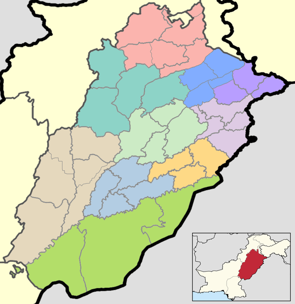
This is a map showing each and every district of Punjab. The map is accurate as of
September 30, 2020
and has been made using data from the Pakistan Bureau of Statistics and UN OCHA's HumData Database (which citypopulation.de uses). Each color depicts a different administrative division (higher than a district but lower than a province).
A category full of these maps listed nicely can be found here . |
| Date | |
| Source | Own work |
| Author | User:Abbasi786786 |
Licensing
I, the copyright holder of this work, hereby publish it under the following license:
This file is licensed under the
Creative Commons
Attribution-Share Alike 4.0 International
license.
-
You are free:
- to share – to copy, distribute and transmit the work
- to remix – to adapt the work
-
Under the following conditions:
- attribution – You must give appropriate credit, provide a link to the license, and indicate if changes were made. You may do so in any reasonable manner, but not in any way that suggests the licensor endorses you or your use.
- share alike – If you remix, transform, or build upon the material, you must distribute your contributions under the same or compatible license as the original.