Dobbingstone_Burn_-_geograph.org.uk_-_1291882.jpg
No higher resolution available.
Summary
| Description |
English:
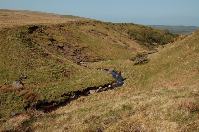
Dobbingstone Burn Looking downstream at the point where the burn enters a narrow part of its valley. This is a typical small burn cutting through relatively soft glacial deposits. The exposed sides show glacial till with all shapes and sizes of stones. The burn course is littered with huge boulders which have been released from the till.
|
| Date | |
| Source | From geograph.org.uk |
| Author | Mary and Angus Hogg |
|
Attribution
( required by the license ) |
Mary and Angus Hogg / Dobbingstone Burn / |
| Camera location |
|
View this and other nearby images on: OpenStreetMap |
|
|---|
_heading:292.00&language=en)
| Object location |
|
View this and other nearby images on: OpenStreetMap |
|
|---|
_heading:292.00&language=en)
Licensing

|
This image was taken from the
Geograph project
collection. See
this photograph's page
on the Geograph website for the photographer's contact details. The copyright on this image is owned by
Mary and Angus Hogg
and is licensed for reuse under the
Creative Commons
Attribution-ShareAlike 2.0 license.
|
This file is licensed under the
Creative Commons
Attribution-Share Alike 2.0 Generic
license.
Attribution:
Mary and Angus Hogg
-
You are free:
- to share – to copy, distribute and transmit the work
- to remix – to adapt the work
-
Under the following conditions:
- attribution – You must give appropriate credit, provide a link to the license, and indicate if changes were made. You may do so in any reasonable manner, but not in any way that suggests the licensor endorses you or your use.
- share alike – If you remix, transform, or build upon the material, you must distribute your contributions under the same or compatible license as the original.

|
The categories of this image need checking. You can do so
here
.
|