Drury_lane_inset_map.png
No higher resolution available.
Summary
Moved from English Wikipedia:
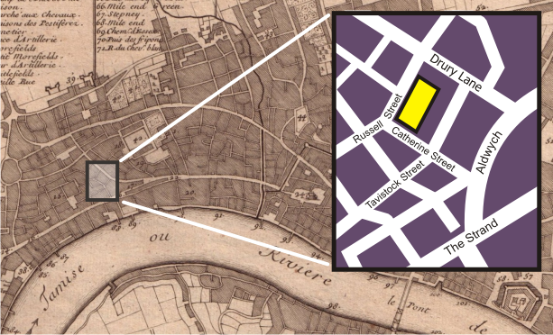
The background of this image is a section of the Public Domain http://commons.wikimedia.org/wiki/Image:Nicolas_de_fer_1700_london.jpg , a 1700 map of London. The inset map, showing the blocks around the Theatre Royal, Drury Lane in 2006, was drawn by myself, Bunchofgrapes, in Corel Draw.
Licensing

|
Permission is granted to copy, distribute and/or modify this document under the terms of the GNU Free Documentation License , Version 1.2 or any later version published by the Free Software Foundation ; with no Invariant Sections, no Front-Cover Texts, and no Back-Cover Texts. A copy of the license is included in the section entitled GNU Free Documentation License . |
|
|
This file is licensed under the Creative Commons Attribution-Share Alike 3.0 Unported license. | |
|
||
| This licensing tag was added to this file as part of the GFDL licensing update . |