Dunedin_central_map.svg

Size of this PNG preview of this SVG file:
424 × 600 pixels
.
Other resolutions:
170 × 240 pixels
|
339 × 480 pixels
|
543 × 768 pixels
|
724 × 1,024 pixels
|
1,448 × 2,048 pixels
|
744 × 1,052 pixels
.
Summary
| Description |
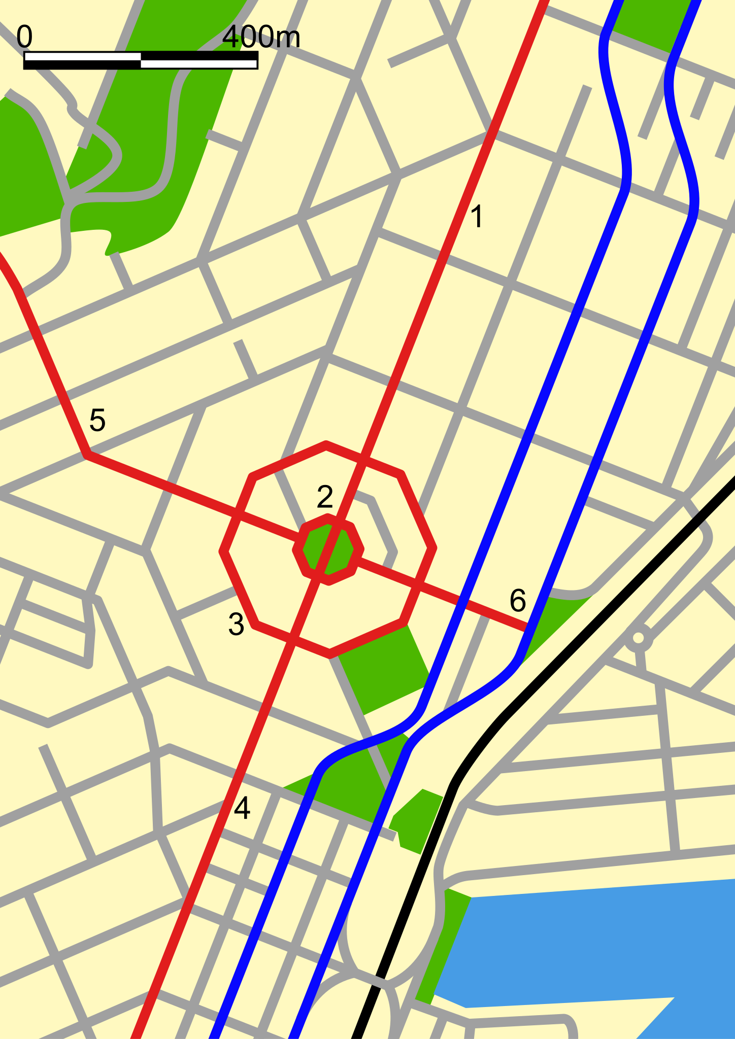
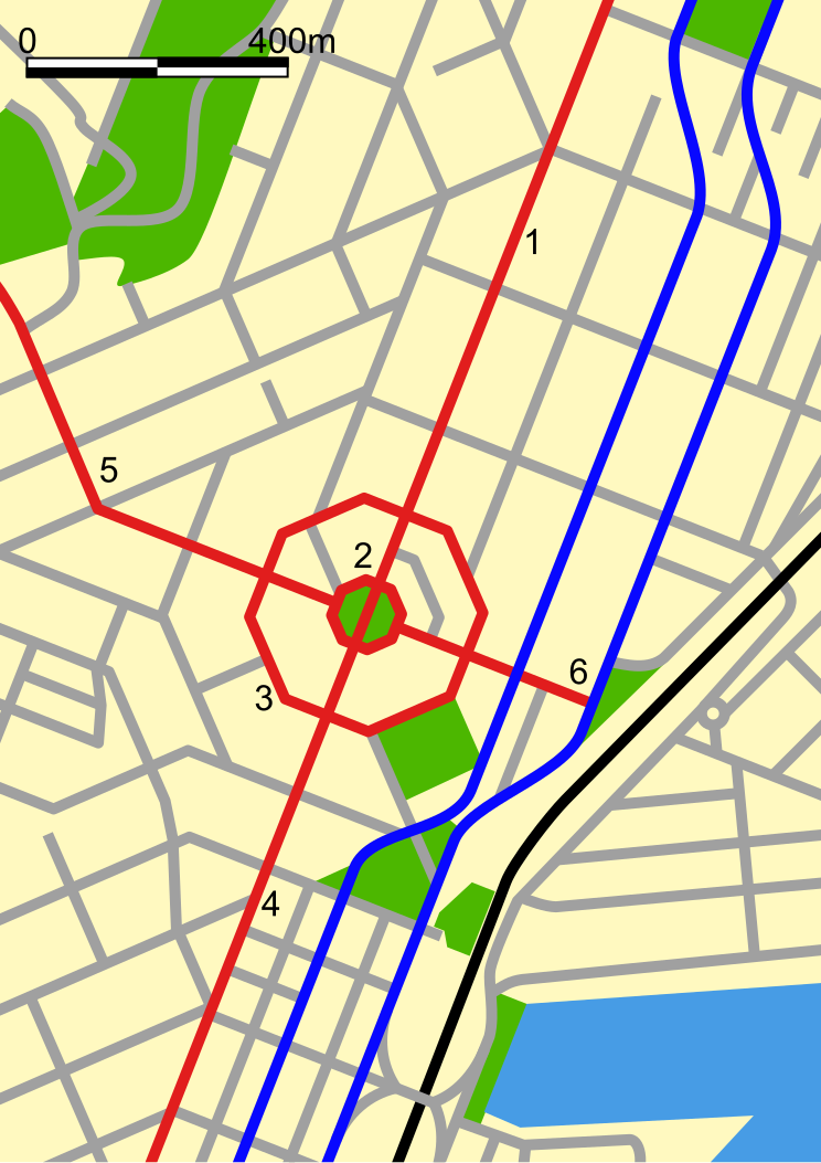
Map of central Dunedin, New Zealand. The black line is the railway, the blue lines are the north/south one-way section of State Highway 1 , the red lines are:
|
| Date | |
| Source | self-made, based on w:Image:Dunedinmap.png map by w:user:Grutness |
| Author | Benchill |
Licensing
I, the copyright holder of this work, hereby publish it under the following license:
|
|
This file is licensed under the Creative Commons Attribution-Share Alike 3.0 Unported license. Subject to disclaimers . | |
|
||
| This licensing tag was added to this file as part of the GFDL licensing update . |

|
Permission is granted to copy, distribute and/or modify this document under the terms of the GNU Free Documentation License , Version 1.2 or any later version published by the Free Software Foundation ; with no Invariant Sections, no Front-Cover Texts, and no Back-Cover Texts. A copy of the license is included in the section entitled GNU Free Documentation License . Subject to disclaimers . |