Durrani_Empire_1747_1862_AD.png
Size of this preview:
768 × 600 pixels
.
Other resolutions:
307 × 240 pixels
|
615 × 480 pixels
|
832 × 650 pixels
.
| Description |
English:
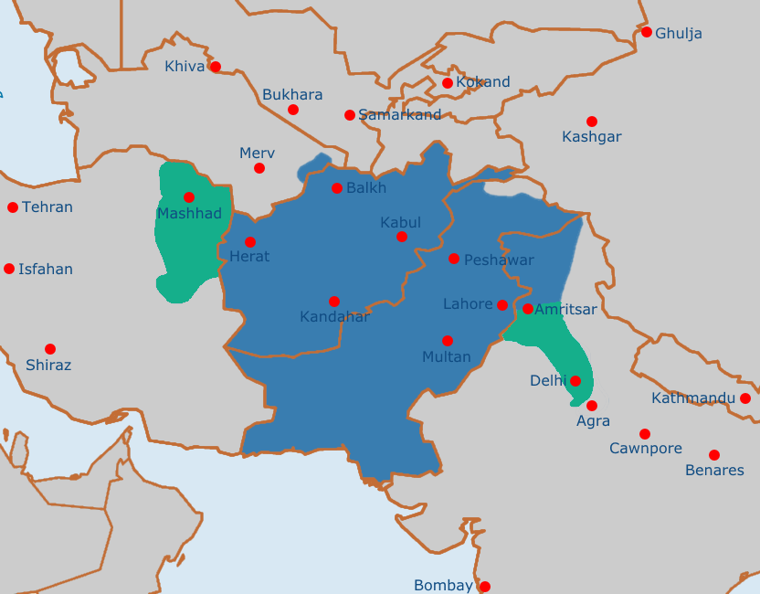
Map of the Afghan Durrani Empire at its greatest extent, circa late 1750s. In green is
de facto
(vassal) control.
|
| Date | |
| Source | https://en.wikipedia.org/wiki/File:Safavid_Empire_1501_1722_AD.png |
| Author | Arab Hafez and edited by me. |
|
|
This file is in the
public domain
because Released into the public domain by the author.
|