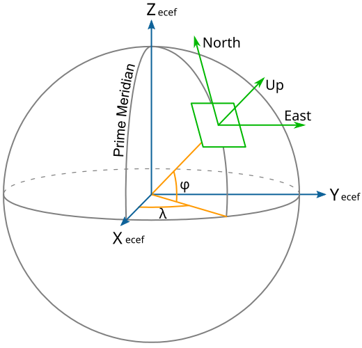
ECEF_ENU_Longitude_Latitude_relationships.svg

Size of this PNG preview of this SVG file:
520 × 500 pixels
.
Other resolutions:
250 × 240 pixels
|
499 × 480 pixels
|
799 × 768 pixels
|
1,065 × 1,024 pixels
|
2,130 × 2,048 pixels
.
| Description | |||
| Date | |||
| Source | Based on en:File:EarthTangentialPlane.png by en:User:Raffyl99 (public domain) | ||
| Author | Mike1024 | ||
|
Permission
( Reusing this file ) |
|
||
| Other versions | en:File:EarthTangentialPlane.png |