East_China_Sea_Map.jpg
No higher resolution available.

|
This
map
image could be re-created
using
vector graphics
as an
SVG
file
. This has several advantages; see
Commons:Media for cleanup
for more information. If an SVG form of this image is available, please upload it and afterwards replace this template with
{{

vector version available

|

new image name

}}
.
It is recommended to name the SVG file “East China Sea Map.svg”—then the template Vector version available (or Vva ) does not need the new image name parameter. |


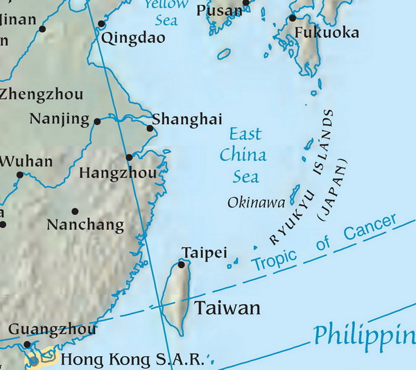
Map of the East China Sea. Mapa Východočínského moře (popisky v angličtině). Source: tr:Resim:DoğuÇinDenizi.jpg Licence: public domain, because it originally comes from the CIA World Factbook, i.e. from a United States federal governemental agency.
|
|
This work has been released into the
public domain
by its author,
Danbury
, at the
English Wikipedia
project
. This applies worldwide.
In case this is not legally possible:
|