Epirus_1205-1230-en.svg

Size of this PNG preview of this SVG file:
734 × 600 pixels
.
Other resolutions:
294 × 240 pixels
|
587 × 480 pixels
|
940 × 768 pixels
|
1,253 × 1,024 pixels
|
2,506 × 2,048 pixels
|
2,002 × 1,636 pixels
.
Summary
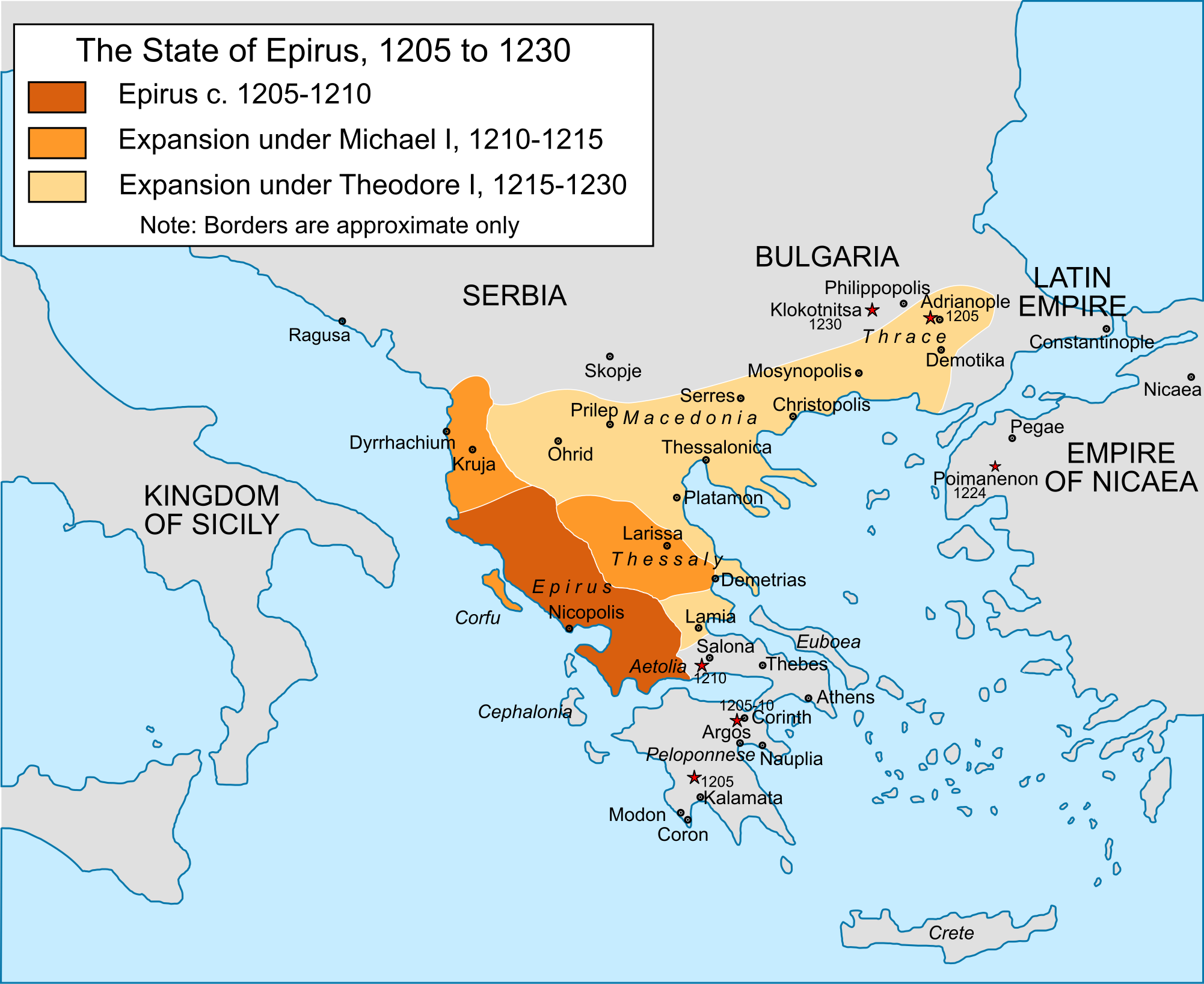
| Description |
English:
Map of the territorial expansion of the
principality of Epirus
under its first two rulers,
Michael I Komnenos Doukas
(1205-15) and
Theodore Komnenos Doukas
(1215-30), including Theodore's "
Empire of Thessalonica
".
|
| Date | |
| Source |
Own work
, extensive correction and reworking of
File:Epiro 1205-1230.svg
based on: John Van Antwerp Fine,
The Late Medieval Balkans: A Critical Survey from the Late Twelfth Century to the Ottoman Conquest
(1994); Konstantinos Varzos,
Η Γενεαλογία των Κομνηνών
(1984); Donald M. Nicol,
The Despotate of Epiros
(1957).
|
| Author | Cplakidas |
| Other versions |
[
]
|


Licensing
I, the copyright holder of this work, hereby publish it under the following license:
This file is licensed under the
Creative Commons
Attribution-Share Alike 4.0 International
license.
-
You are free:
- to share – to copy, distribute and transmit the work
- to remix – to adapt the work
-
Under the following conditions:
- attribution – You must give appropriate credit, provide a link to the license, and indicate if changes were made. You may do so in any reasonable manner, but not in any way that suggests the licensor endorses you or your use.
- share alike – If you remix, transform, or build upon the material, you must distribute your contributions under the same or compatible license as the original.