Ethiopia_shaded_relief_map_1999,_CIA.jpg

Size of this preview:
498 × 599 pixels
.
Other resolutions:
199 × 240 pixels
|
399 × 480 pixels
|
1,010 × 1,215 pixels
.
Summary
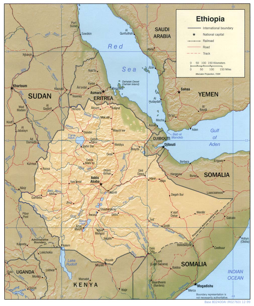
| Description | Shaded relief map of Ethiopia , 1999, produced by the U.S. Central Intelligence Agency. |
| Date | |
| Source |
University of Texas Libraries, Perry-Castañeda Library Map Collection: Ethiopia Maps |
| Author | CIA |
| Other versions |
Derivative works of this file: |
Licensing
|
|
This image is a work of a
Central Intelligence Agency
employee, taken or made as part of that person's official duties. As a Work of the United States Government, this image or media is in the
public domain
in the United States.
|

|