Ethnic_Caucasia-en.png
Size of this preview:
473 × 599 pixels
.
Other resolutions:
189 × 240 pixels
|
379 × 480 pixels
|
607 × 768 pixels
|
1,200 × 1,519 pixels
.
Summary

| Description |
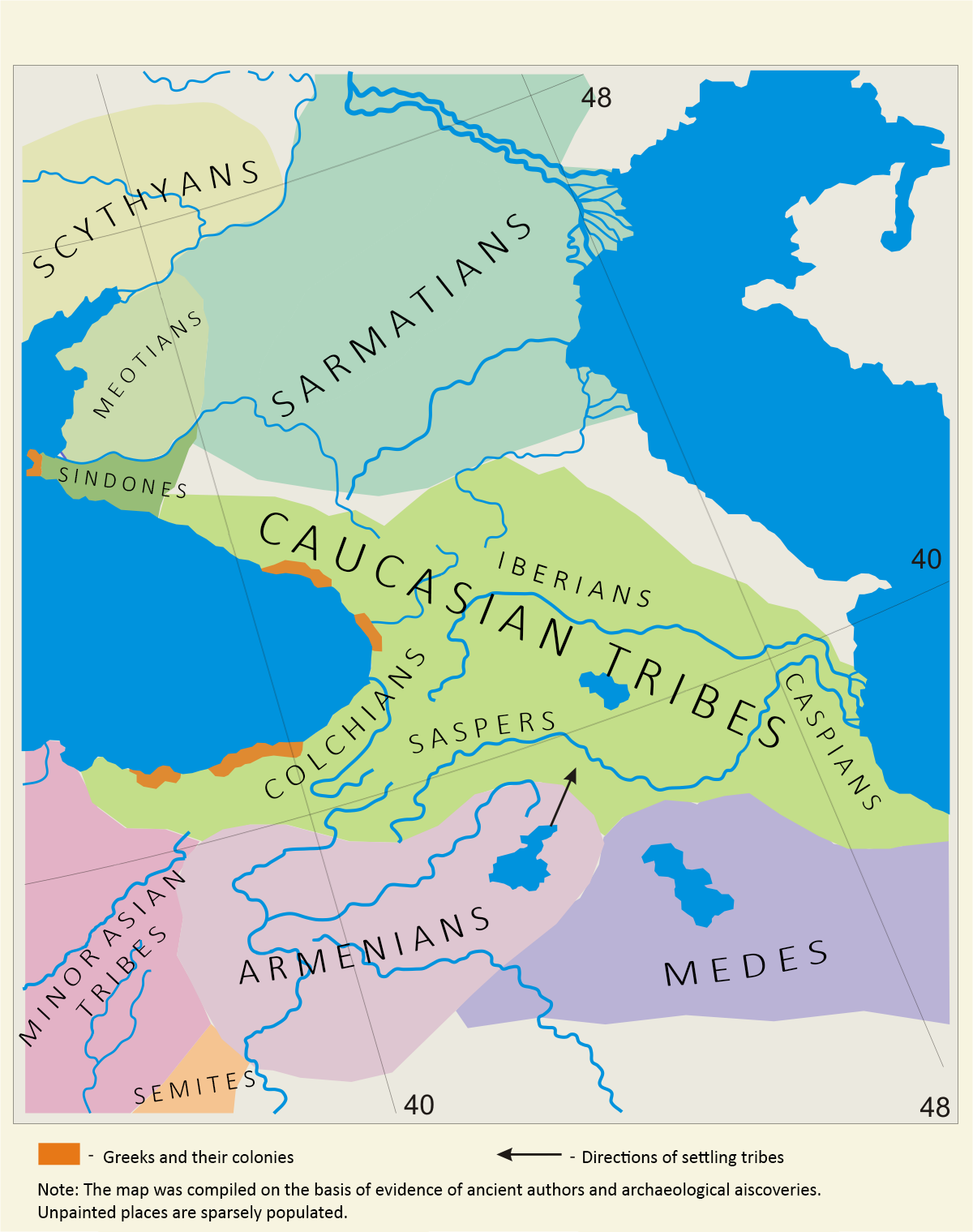
English:
The Ethnic Map of Caucasus - centuries V - IV B.C.E., by "The World History", Vol.2, 1956 г., Russia
|
| Date | |
| Source | The Ethnic Map of Caucasus V - IV B.C., (fragment of the Ethnic Map of Europe V - IV B.C.), "The World History", Vol.2, 1956 г., Russia, Moscow, Autors: A. Belyavsky, L. Lazarevich, A. Mongait. and Gocha Tsetskhladze (éd.), Greek Colonisation. An Account of Greek Colonies and Other Settlements Overseas, 2 volumes, Leyde ; Boston, Brill, 2006 et 2008, 584 et 566 p. |
| Author | Ercwlff |
| Other versions |


|
Licensing
I, the copyright holder of this work, hereby publish it under the following license:
This file is licensed under the
Creative Commons
Attribution-Share Alike 3.0 Unported
license.
-
You are free:
- to share – to copy, distribute and transmit the work
- to remix – to adapt the work
-
Under the following conditions:
- attribution – You must give appropriate credit, provide a link to the license, and indicate if changes were made. You may do so in any reasonable manner, but not in any way that suggests the licensor endorses you or your use.
- share alike – If you remix, transform, or build upon the material, you must distribute your contributions under the same or compatible license as the original.