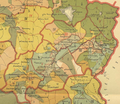
Ethnographic_map_of_the_Kars_Oblast-1902.png

Size of this preview:
800 × 543 pixels
.
Other resolutions:
320 × 217 pixels
|
640 × 434 pixels
|
1,024 × 694 pixels
|
1,280 × 868 pixels
|
2,560 × 1,736 pixels
|
4,956 × 3,361 pixels
.
Summary
| Description Ethnographic map of the Kars Oblast-1902.png |
English:
Ethnographic map of the Kars Oblast
Русский:
Этнографическая карта Карсской области
|
| Date | (according to the census of 1886) |
| Source |
Русский:
XXXI. Списки административного деления губерний и областей Закавказья на уезды округа, полицейские участки сельские общества с показанием расстояний, числа населенных мест, стр. 316-317 // Сборникь Статистическихь свѣдѣній по Закавказскому краю. Составлень, по постановленію Закавказскаго Статистическаго Комитета, состоящимь при немь Отделомь, подь редакціей старшаго редактора отдела Е. Кондратенко. Часть I. ( с картами Елисаветопольский уезд, 20 верст в дюйме, этнографические:Бакинская губерния, Дагестанская область,Карсская область,Тифлисская губерния,Черноморская губерния,Эриванская губерния) Тифлись: Печатано в типографiях: Грузинскаго Издательскаго Т—ва, М. Шарадзе и Либермана, 1902 г.
|
| Author |
Русский:
Е.И. Кондратенко
|
| Other versions |
|
Licensing
|
This is a faithful photographic reproduction of a two-dimensional,
public domain
work of art. The work of art itself is in the public domain for the following reason:
The official position taken by the Wikimedia Foundation is that "
faithful reproductions of two-dimensional public domain works of art are public domain
".
This photographic reproduction is therefore also considered to be in the public domain in the United States. In other jurisdictions, re-use of this content may be restricted; see Reuse of PD-Art photographs for details. |
|||||
Captions
Add a one-line explanation of what this file represents


