Europa_Germanen_50_n_Chr.svg

Size of this PNG preview of this SVG file:
800 × 557 pixels
.
Other resolutions:
320 × 223 pixels
|
640 × 445 pixels
|
1,024 × 713 pixels
|
1,280 × 891 pixels
|
2,560 × 1,782 pixels
|
941 × 655 pixels
.
Belege
Es fehlen die zugrunde liegenden Quellenangaben für die Erstellung der Karte. -- 84.137.56.234 22:25, 19 January 2013 (UTC)
Summary
| Description |
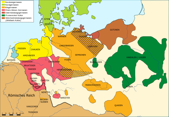
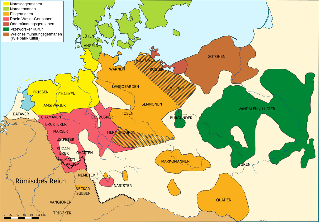
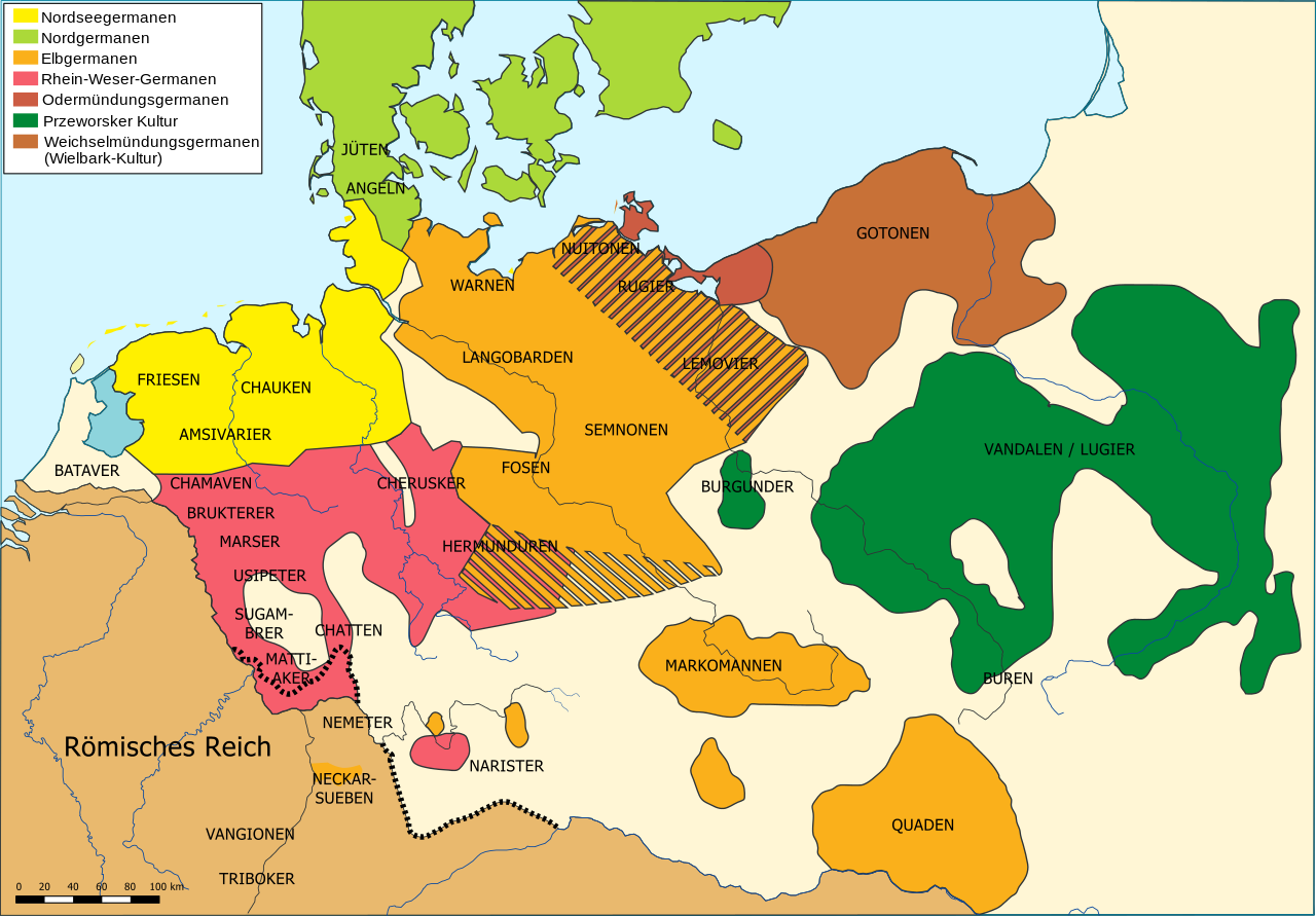
Deutsch:
Die räumliche Verteilung germanischer Volksgruppen um 50 n. Chr. (siehe auch
Germanen
)
English:
The distribution of Germanic ethnic groups during the first century AD
Français :
Carte des peuples germaniques au 1er siècle après J.-C.
|
| Date | |
| Source | Own work |
| Author | Karl Udo Gerth |
| Other versions |
Abgeleitete Werke dieser Datei:
|
| SVG development |


Licensing
|
|
I, the copyright holder of this work, release this work into the
public domain
. This applies worldwide.
In some countries this may not be legally possible; if so: I grant anyone the right to use this work for any purpose , without any conditions, unless such conditions are required by law. |