Europe_1740_en.png

Size of this preview:
800 × 570 pixels
.
Other resolutions:
320 × 228 pixels
|
640 × 456 pixels
|
1,024 × 730 pixels
|
1,280 × 913 pixels
|
2,560 × 1,825 pixels
|
3,872 × 2,761 pixels
.
_en.png)
.png)
.jpg)
Summary
| Description |
English:
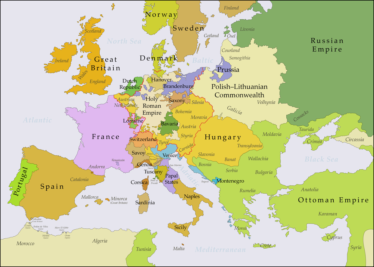
This map shows Europe in the years between the 1739
Treaty of Belgrade
(the end of the
Austro–Turkish War (1737–39)
) and the beginning of the
War of the Austrian Succession
in 1740. The red line marks the borders of the
Holy Roman Empire
. The work was created with
Inkscape
and is mainly based on a map in:
Putzger - Historischer Weltatlas
, Berlin 1990, 78 pp.
|
| Date | |
| Source | Own work , based on File:Europe 1748-1766 en.png |
| Author | Bryan Rutherford |
Licensing
I, the copyright holder of this work, hereby publish it under the following license:
This file is licensed under the
Creative Commons
Attribution-Share Alike 4.0 International
license.
-
You are free:
- to share – to copy, distribute and transmit the work
- to remix – to adapt the work
-
Under the following conditions:
- attribution – You must give appropriate credit, provide a link to the license, and indicate if changes were made. You may do so in any reasonable manner, but not in any way that suggests the licensor endorses you or your use.
- share alike – If you remix, transform, or build upon the material, you must distribute your contributions under the same or compatible license as the original.