Europe_biogeography_countries.svg

Size of this PNG preview of this SVG file:
800 × 564 pixels
.
Other resolutions:
320 × 225 pixels
|
640 × 451 pixels
|
1,024 × 722 pixels
|
1,280 × 902 pixels
|
2,560 × 1,804 pixels
|
3,535 × 2,491 pixels
.
Summary
| Description |
English:
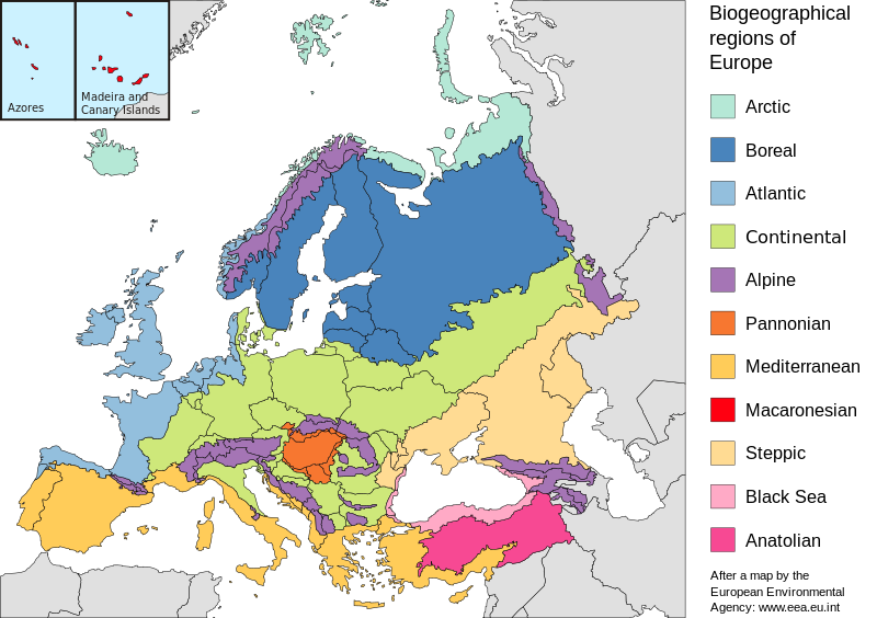
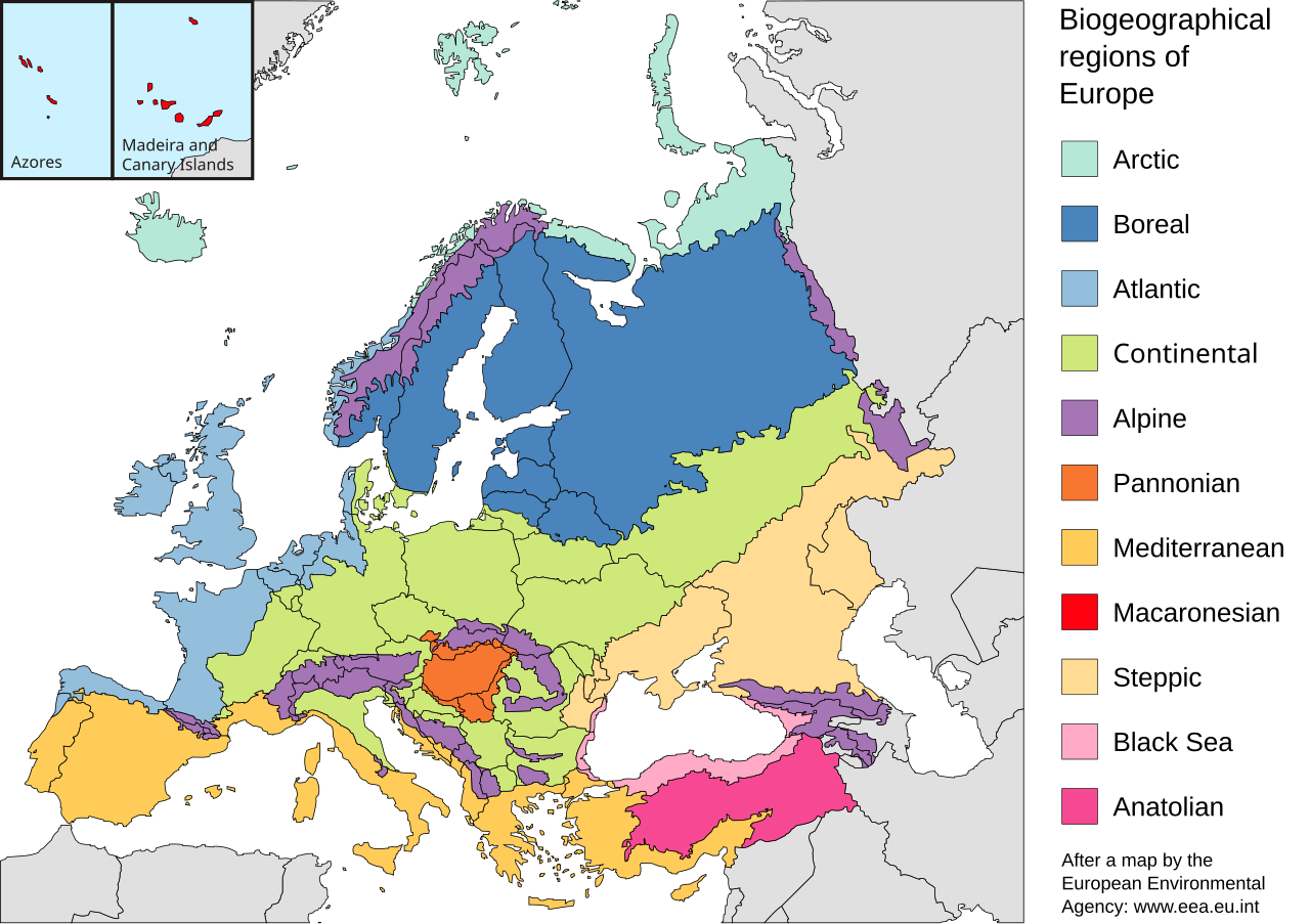
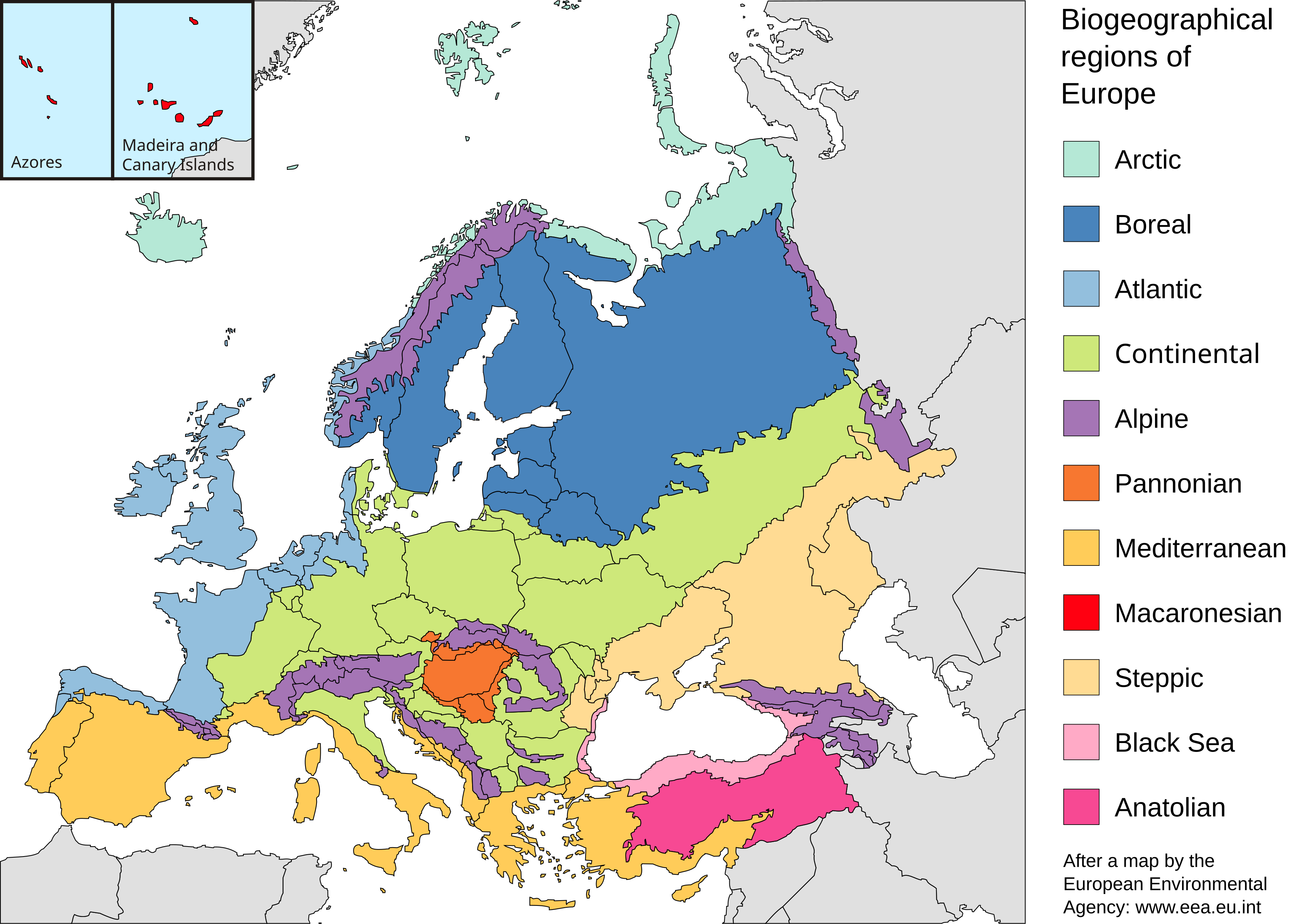
Map of the biogeographic regions of Europe, after EEA's map. Shows both country and biogeographical region boundaries. Legend in English. SVG format.
Español:
Regiones biogeográficas de Europa.
Português:
Regiões biogeográficas da Europa e regiões adjacentes.
한국어:
Biogeographic regions. Biogeographic regions(Biogeographic regions.
Türkçe:
Avrupa'nın Biyocoğrafik Bölgeleri (Türkiye'nin Asya kısmı da dahil).
Dansk:
Pannonisk klima er her angivet med orange farve, der dækker dele af Slovakiet, Østrig, Serbien og Rumænien samt hele Ungarn.
Galego:
Rexións bioxeográficas de Europa.
Norsk bokmål:
Biogeografiske områder i Europa.
Norsk nynorsk:
Biogeografiske område i Europa.
پښتو:
Biogeographic regions of Europe.
Mirandés:
Regiones biogeográficas de la Ouropa.
|
| Date | |
| Source | Made with Inkscape from Image:Biogeographical Regions Europe - Map (intl).png by the European Environmental Agency |
| Author | Júlio Reis |
| Other versions |
Regions only:
Image:Europe biogeography regions.svg
; blank map:
Image:Europe biogeography blank.svg


|
.png)
Licensing
This file is licensed under the
Creative Commons
Attribution-Share Alike 3.0 Unported
license.
-
You are free:
- to share – to copy, distribute and transmit the work
- to remix – to adapt the work
-
Under the following conditions:
- attribution – You must give appropriate credit, provide a link to the license, and indicate if changes were made. You may do so in any reasonable manner, but not in any way that suggests the licensor endorses you or your use.
- share alike – If you remix, transform, or build upon the material, you must distribute your contributions under the same or compatible license as the original.