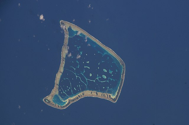
Fakaofo_Satellite_NASA.jpg

Size of this preview:
800 × 529 pixels
.
Other resolutions:
320 × 212 pixels
|
640 × 423 pixels
|
1,024 × 677 pixels
|
1,280 × 846 pixels
|
3,032 × 2,004 pixels
.
Summary
| Description | |
| Date | |
| Source |
|
| Author | NASA Johnson Space Center |
| Object location |
|
View this and other nearby images on: OpenStreetMap |
|
|---|
|
|
This image or video was catalogued by one of the centers of the United States
National Aeronautics and Space Administration
(NASA) under
Photo ID:
ISS006-E-39657
.
This tag does not indicate the copyright status of the attached work. A normal copyright tag is still required. See Commons:Licensing .
Other languages:
|
Licensing
|
|
This file is in the public domain in the United States because it was solely created by NASA . NASA copyright policy states that "NASA material is not protected by copyright unless noted ". (See Template:PD-USGov , NASA copyright policy page or JPL Image Use Policy .) |
|

|
Warnings:
|

|
This image has been assessed under the valued image criteria and is considered the most valued image on Commons within the scope: Fakaofo atoll, Tokelau - satellite view . You can see its nomination here . |