Faroe_Islands,_Borðoy,_Klaksvík_(3).jpg

Size of this preview:
800 × 531 pixels
.
Other resolutions:
320 × 213 pixels
|
640 × 425 pixels
|
1,024 × 680 pixels
|
1,280 × 850 pixels
|
2,144 × 1,424 pixels
.
Summary
| Description |
English:
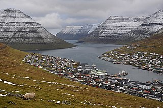
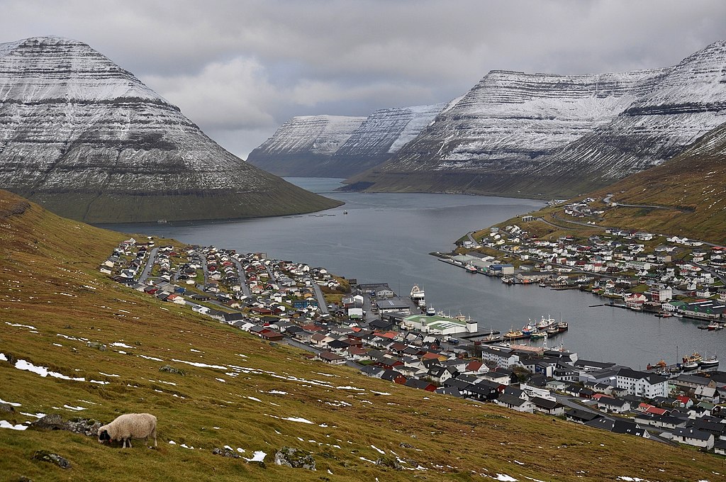
View over Klaksvík (Borðoy, Faroe Islands, Denmark), looking north into the Haraldssund fjord. At left is the island of Kunoy.
Nederlands:
Uitzicht op Klaksvík (Borðoy, Faroe Islands, Denemarken), kijkend naar het noorden naar de Haraldssund fjord. Links het eiland Kunoy.
|
| Date | |
| Source | Own work |
| Author | Vincent van Zeijst |
| Other versions |


Seen from Astarbravt (Niðan Horn) at:
| Camera location |
|
View this and other nearby images on: OpenStreetMap |
|
|---|
.jpg¶ms=062.226906_N_-006.608083_E_globe:Earth_type:camera_region:FO_&language=en)
Licensing
I, the copyright holder of this work, hereby publish it under the following license:
This file is licensed under the
Creative Commons
Attribution-Share Alike 3.0 Unported
license.
-
You are free:
- to share – to copy, distribute and transmit the work
- to remix – to adapt the work
-
Under the following conditions:
- attribution – You must give appropriate credit, provide a link to the license, and indicate if changes were made. You may do so in any reasonable manner, but not in any way that suggests the licensor endorses you or your use.
- share alike – If you remix, transform, or build upon the material, you must distribute your contributions under the same or compatible license as the original.
| Annotations | This image is annotated: View the annotations at Commons |
.jpg)