Fertility_rate_world_map_2.png

Size of this preview:
800 × 410 pixels
.
Other resolutions:
320 × 164 pixels
|
864 × 443 pixels
.

|
File:Total Fertility Rate Map by Country.svg
is a vector version of this file. It should be used in place of this PNG file when not inferior.
File:Fertility rate world map 2.png →
File:Total Fertility Rate Map by Country.svg
For more information, see
Help:SVG
.
|

|
Summary
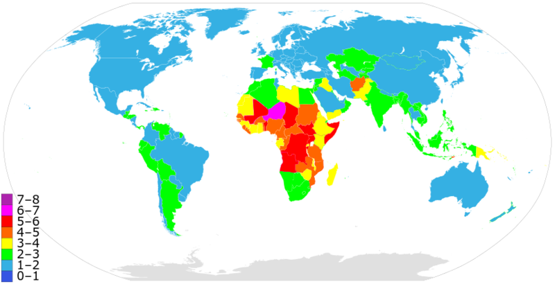
A more precise world map of country fertility rates, as listed at w:List of countries and territories by fertility rate . Note that this version is using outdated data; newer figures (e.g. 2015) are available
See also: Image:Fertility rate world map.PNG from 2006.
Licensing
|
|
I, the copyright holder of this work, release this work into the
public domain
. This applies worldwide.
In some countries this may not be legally possible; if so: I grant anyone the right to use this work for any purpose , without any conditions, unless such conditions are required by law. |