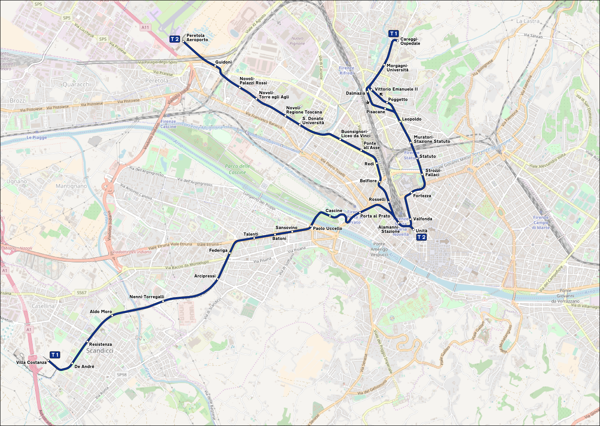
Firenze_-_mappa_rete_tranviaria.png
Size of this preview:
800 × 569 pixels
.
Other resolutions:
320 × 228 pixels
|
640 × 455 pixels
|
1,024 × 728 pixels
|
1,280 × 910 pixels
|
2,000 × 1,422 pixels
.
Summary
| Description |
Italiano:
Mappa della rete tranviaria di Firenze.
|
|||
| Date | (see file history) | |||
| Source | openstreetmap.org | |||
| Creator |
OpenStreetMap contributors
|
|||
|
Permission
( Reusing this file ) |
OpenStreetMap data is available under the Open Database License ( details ). Map tiles are licensed under the Creative Commons Attribution-ShareAlike 2.0 license (CC-BY-SA 2.0).
This file is licensed under the
Creative Commons
Attribution-Share Alike 2.0 Generic
license.
|
|||
| Georeferencing | If inappropriate please set warp_status = skip to hide. | |||
| Other versions |
|

