Firthofclydemap.png
Size of this preview:
531 × 600 pixels
.
Other resolutions:
212 × 240 pixels
|
541 × 611 pixels
.
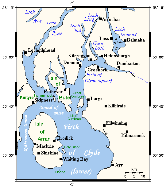
Map of the Firth of Clyde and surrounding lands and waters on the western coast of Scotland.
This map's source is here archive copy at the Wayback Machine , with the uploader's modifications, and the GMT homepage archive copy at the Wayback Machine says that the tools are released under the GNU General Public License.

|
Permission is granted to copy, distribute and/or modify this document under the terms of the GNU Free Documentation License , Version 1.2 or any later version published by the Free Software Foundation ; with no Invariant Sections, no Front-Cover Texts, and no Back-Cover Texts. A copy of the license is included in the section entitled GNU Free Documentation License . |
|
|
This file is licensed under the Creative Commons Attribution-Share Alike 3.0 Unported license. | |
|
||
| This licensing tag was added to this file as part of the GFDL licensing update . |