French_Proposal_4_April_1946.jpg
Size of this preview:
457 × 599 pixels
.
Other resolutions:
183 × 240 pixels
|
366 × 480 pixels
|
641 × 840 pixels
.
Summary
| Description |
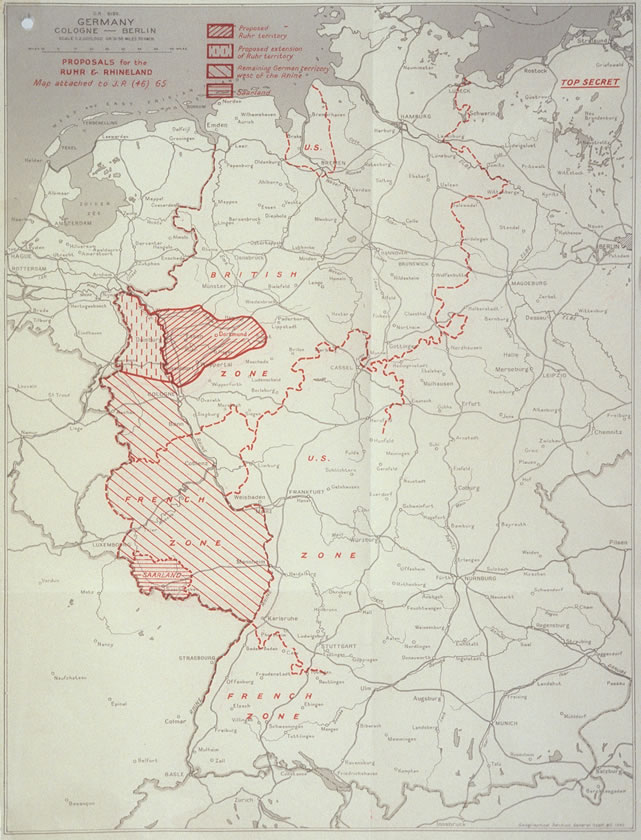
English:
French Proposal for the Ruhr Area and the Rhineland.
日本語:
ルール地域とラインラントに関するフランスの提案を示した地図。英国が作成。
|
| Date | |
| Source | http://zis.uibk.ac.at:81/zisneu/dokumente/karten/4.php |
| Author | The UK Chiefs of Staff Committee |
Licensing
|
|
This work
created by the United Kingdom Government
is in the
public domain
.
This is because it is one of the following :
HMSO has declared that the expiry of Crown Copyrights applies worldwide (ref:
HMSO Email Reply
)
|

|
Original upload log
The original description page was
here
. All following user names refer to en.wikipedia.
- 2008-07-06 14:34 Stor stark7 641×840× (126817 bytes) {{Information |Description= French Proposal for the Ruhr Area and the Rhineland. |Source=http://zis.uibk.ac.at:81/zisneu/dokumente/karten/4.php |Date=4.4.1946 |Author=The UK Chiefs of Staff Committee |Permission= UK crown copyright (which is what applies