Gamla_uppsala.jpg

Size of this preview:
800 × 352 pixels
.
Other resolutions:
320 × 141 pixels
|
837 × 368 pixels
.
Summary
| Description |
Deutsch:
Hügelgräber in
Alt-Uppsala
, Schweden.
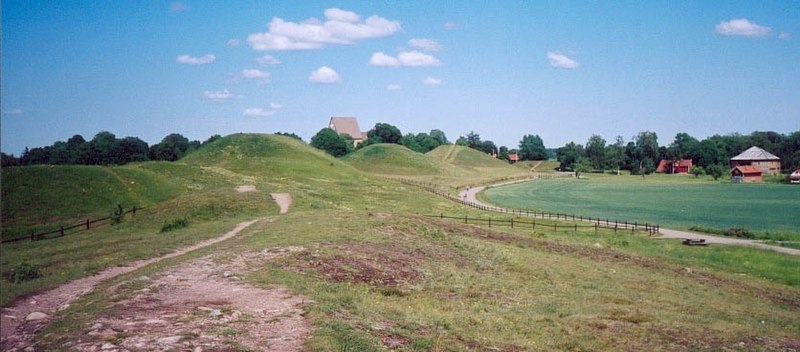
English:
Royal mounds in Gamla Uppsala ("Old Uppsala") in Sweden.
Svenska:
Gamla Uppsala fornminnesområde.
|
||
| Date | circa 1998 –2000 | ||
| Source | First uploaded Juni 30, 2003 to sv:Wikipedia by user OlofE | ||
| Author | OlofE |
| Camera location |
|
View this and other nearby images on: OpenStreetMap |
|
|---|
Licensing

|
Permission is granted to copy, distribute and/or modify this document under the terms of the GNU Free Documentation License , Version 1.2 or any later version published by the Free Software Foundation ; with no Invariant Sections, no Front-Cover Texts, and no Back-Cover Texts. A copy of the license is included in the section entitled GNU Free Documentation License . |
|
|
This file is licensed under the Creative Commons Attribution-Share Alike 3.0 Unported license. | |
|
||
| This licensing tag was added to this file as part of the GFDL licensing update . |