Germany_Morgenthau_Plan-en.svg

Size of this PNG preview of this SVG file:
666 × 599 pixels
.
Other resolutions:
267 × 240 pixels
|
533 × 480 pixels
|
853 × 768 pixels
|
1,138 × 1,024 pixels
|
2,276 × 2,048 pixels
|
1,000 × 900 pixels
.
Summary
| Description |
English:
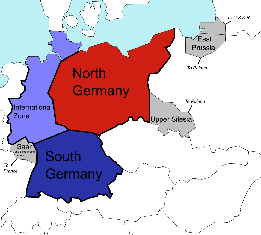
The (1944) U.S. "Morgenthau Plan" showing the planned partitioning of Germany into a North State, a South State, and an International zone. Areas in grey are areas intended for annexation by France, Poland and the U.S.S.R.
|
| Date | |
| Source |
This file was derived from:
Germany Morgenthau Plan.png
:
|
| Author |
Original:
Vector:
|
| SVG development |
Licensing
|
|
I, the copyright holder of this work, release this work into the
public domain
. This applies worldwide.
In some countries this may not be legally possible; if so: I grant anyone the right to use this work for any purpose , without any conditions, unless such conditions are required by law. |
Original upload log
This image is a derivative work of the following images:
-
File:
Germany Morgenthau Plan.png
licensed with Cc-by-sa-3.0-migrated, GFDL, PD-self
- 2006-07-06T08:40:57Z Stor stark7 998x896 (149331 Bytes) The (1944) "Morgenthau Plan" map showing the planned partitioning of Germany into a North State, a South State, and an International zone. Areas in grey are areas proposed for annexation by France, Poland, and the U.S.S.R.(to
- 2006-07-05T20:52:36Z Stor stark7 998x896 (149331 Bytes) The background template used for this image was the following fre license image: http://upload.wikimedia.org/wikipedia/commons/4/43/Duitslandmorgenthau.png The Modification of the map, in order to portray the dismemberment o
- 2006-03-18T15:00:50Z Stor stark7 998x896 (147165 Bytes) own made
Uploaded with derivativeFX