Global_Map_of_Wind_Power_Density_Potential.png
Size of this preview:
800 × 477 pixels
.
Other resolutions:
320 × 191 pixels
|
640 × 381 pixels
|
1,024 × 610 pixels
|
1,280 × 763 pixels
|
2,500 × 1,490 pixels
.
Summary
| Description |
English:
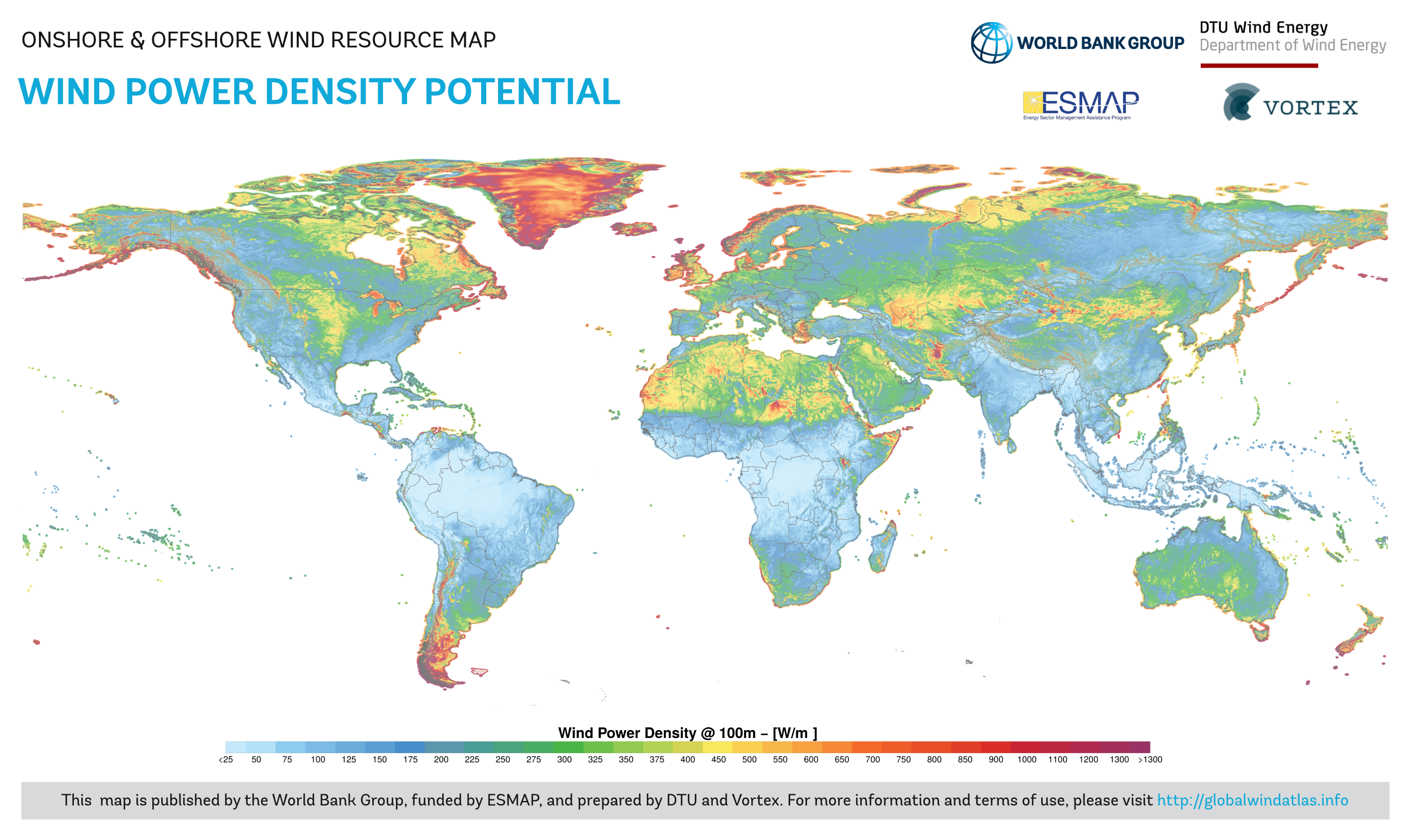
This wind resource map provides an estimated summary of mean wind power density at 100 m above surface level. Power density indicates wind power potential, part of which can be extracted by wind turbines. The map is derived from high-resolution wind speed distributions based on a chain of models, which downscales winds from global models (~70 km), to mesoscale (9 km) to microscale (150 m terrain). The output resolution is 1 km.
|
||
| Date | |||
| Source | https://globalwindatlas.info | ||
| Author | Technical University of Denmark (DTU) | ||
|
Permission
( Reusing this file ) |
https://globalsolaratlas.info/support/terms-of-use
|
Licensing
This file is licensed under the
Creative Commons
Attribution 4.0 International
license.
-
You are free:
- to share – to copy, distribute and transmit the work
- to remix – to adapt the work
-
Under the following conditions:
- attribution – You must give appropriate credit, provide a link to the license, and indicate if changes were made. You may do so in any reasonable manner, but not in any way that suggests the licensor endorses you or your use.