Great_Ouse_Relief_Channel.jpg

Size of this preview:
800 × 600 pixels
.
Other resolutions:
320 × 240 pixels
|
640 × 480 pixels
|
1,024 × 768 pixels
|
1,280 × 960 pixels
|
2,560 × 1,920 pixels
.
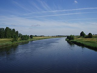
| Description | The River Great Ouse relief channel, a "6½ mile navigable channel from a lock at Denver Sluice to Wiggenhall Bridge just over two miles south of King's Lynn." ( more information ). This photo was taken from the disused railway bridge near Wiggenhall St. Mary Magdalen (Norfolk) which crosses it. |
| Date | some time last month |
| Source | Own work |
| Author | Lewis Collard |
| Camera location |
|
View this and other nearby images on: OpenStreetMap |
|
|---|

|
The copyright holder of this file, Lewis Collard , allows anyone to use it for any purpose, provided that the copyright holder is properly attributed. Redistribution, derivative work, commercial use, and all other use is permitted. |
|
Attribution:
Lewis Collard
|