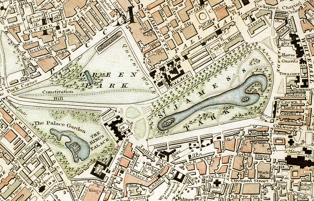
Green_Park_and_St._James's_Park_London_from_1833_Schmollinger_map.jpg

| Description |
English:
Green Park, St. James's Park and Buckingham Palace section of "Improved map of London for 1833, from Actual Survey. Engraved by W. Schmollinger, 27 Goswell Terrace", photographed for Wikipedia by
User:Pointillist
. All rights of the photographer are hereby released.
The monarch at the time the map was published was
William IV
.
|
|||||
| Date | ||||||
| Source | http://en.wikipedia.org/wiki/Image:Green_Park_and_St._James's_Park_London_from_1833_Schmollinger_map.jpg#filelinks | |||||
| Author | en:User:Pointillist | |||||
|
Permission
( Reusing this file ) |
|
|||||