Hacha_grande_from_papagayo_pano.jpg
Size of this preview:
800 × 181 pixels
.
Other resolutions:
320 × 72 pixels
|
640 × 145 pixels
|
1,024 × 231 pixels
|
4,000 × 904 pixels
.
Hacha Grande detta anche Cima Segantini
|

Summary
| Camera location |
|
View this and other nearby images on: OpenStreetMap |
|
|---|
| Description |
English:
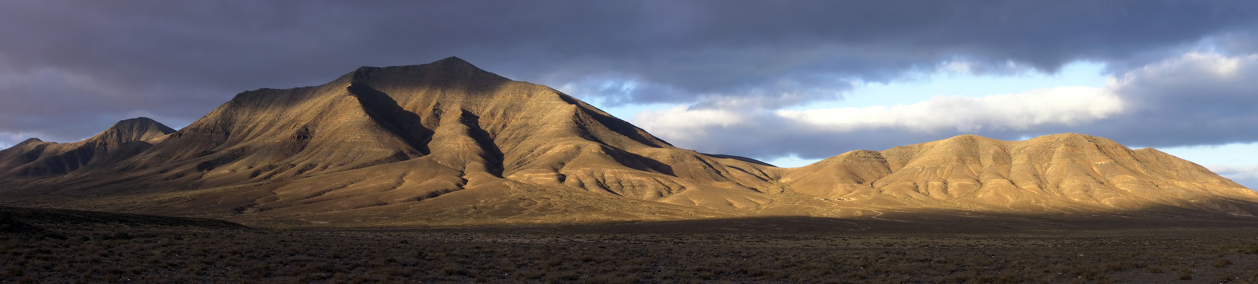
Hacha Grande (562m), the Degollada Valle Perdomo, Montaña Breña Estesa and the Morros de Hacha Chica (left to right) viewed across the arid plain of El Rubicón from the road to the Monumento Natural de los Ajaches (Punta de Papagayo), on the Canary Island of Lanzarote. Pico Redondo (562m) is visible on the far left. Lanzarote is a volcanic island with very low rainfall; much of the south of the island is desert and a barren expanse of lava flows. Lanzarote (Canary Islands, Spain).
Français :
De gauche à droite : Pico Redondo (loin à gauche, 562m), Hacha Grande (562m), la Degollada Valle Perdomo, la Montaña Breña Estesa et les Morros de Hacha Chica, vus derrière les plaines arides d'El Rubicón depuis la route menant au Monumento Natural de los Ajaches (Punta de Papagayo), sur l'île de
Lanzarote
, dans les Canaries (Espagne). Lanzarote est une île volcanique et aride, le sud de l'île est un désert de laves.
|
| Date | |
| Source | Own work |
| Author | Yummifruitbat |
|
Permission
( Reusing this file ) |
See license details |
Location from Wikipedia en:Hacha_Grande .
Licensing
I, the copyright holder of this work, hereby publish it under the following license:
This file is licensed under the
Creative Commons
Attribution-Share Alike 2.5 Generic
license.
-
You are free:
- to share – to copy, distribute and transmit the work
- to remix – to adapt the work
-
Under the following conditions:
- attribution – You must give appropriate credit, provide a link to the license, and indicate if changes were made. You may do so in any reasonable manner, but not in any way that suggests the licensor endorses you or your use.
- share alike – If you remix, transform, or build upon the material, you must distribute your contributions under the same or compatible license as the original.
| Annotations | This image is annotated: View the annotations at Commons |