Haiti_communes.png
Size of this preview:
800 × 530 pixels
.
Other resolutions:
320 × 212 pixels
|
640 × 424 pixels
|
1,024 × 679 pixels
|
1,281 × 849 pixels
.
Summary
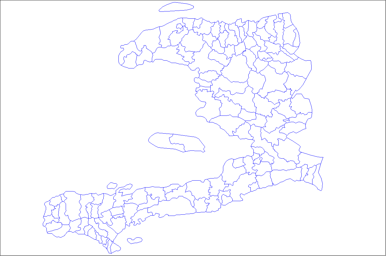
| Description | Map of the communes of Haiti. Created by Rarelibra 21:03, 27 April 2007 (UTC) for public domain use, using MapInfo Professional v8.5 and various mapping resources. |
| Date | 27 April 2007 (original upload date) |
| Source | No machine-readable source provided. Own work assumed (based on copyright claims). |
| Author | No machine-readable author provided. Rarelibra assumed (based on copyright claims). |
Licensing
|
|
I, the copyright holder of this work, release this work into the
public domain
. This applies worldwide.
In some countries this may not be legally possible; if so: I grant anyone the right to use this work for any purpose , without any conditions, unless such conditions are required by law. |