Heathrow_Airport_-_geograph.org.uk_-_231165.jpg
No higher resolution available.
Summary
| Description |
English:
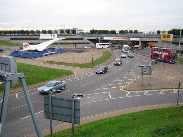
Heathrow Airport. This one third scale model of Concorde is at the northern end of the vehicle tunnel to Terminals 1, 2 and 3 at Heathrow, and at the southern end of the M4 Motorway spur. The right hand one of the two white coaches is emerging from the northbound tunnel from the Terminals. The airport itself opened for civilian use in 1946. The photo was taken from the A4 Bath Road overbridge.
|
| Date | |
| Source | From geograph.org.uk |
| Author | Nigel Cox |
|
Attribution
( required by the license ) |
Nigel Cox / Heathrow Airport / |
| Camera location |
|
View this and other nearby images on: OpenStreetMap |
|
|---|
_heading:135.00&language=en)
| Object location |
|
View this and other nearby images on: OpenStreetMap |
|
|---|
_heading:135.00&language=en)
Licensing

|
This image was taken from the
Geograph project
collection. See
this photograph's page
on the Geograph website for the photographer's contact details. The copyright on this image is owned by
Nigel Cox
and is licensed for reuse under the
Creative Commons
Attribution-ShareAlike 2.0 license.
|
This file is licensed under the
Creative Commons
Attribution-Share Alike 2.0 Generic
license.
Attribution:
Nigel Cox
-
You are free:
- to share – to copy, distribute and transmit the work
- to remix – to adapt the work
-
Under the following conditions:
- attribution – You must give appropriate credit, provide a link to the license, and indicate if changes were made. You may do so in any reasonable manner, but not in any way that suggests the licensor endorses you or your use.
- share alike – If you remix, transform, or build upon the material, you must distribute your contributions under the same or compatible license as the original.