History_of_NATO_enlargement.svg

Size of this PNG preview of this SVG file:
512 × 394 pixels
.
Other resolutions:
312 × 240 pixels
|
624 × 480 pixels
|
998 × 768 pixels
|
1,280 × 985 pixels
|
2,560 × 1,970 pixels
.
Summary
| Description |
Dansk
:
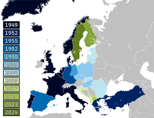
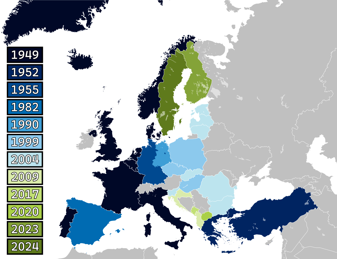
Kort over NATOs historiske udvidelser i Europa.
Esperanto
:
Mapo de la historia ekspansio de NATO en Eŭropo.
Polski
:
Mapa historycznej ekspansji NATO w Europie.
Suomi
:
Kartta Naton historiallisesta laajentumisesta Euroopassa.
Svenska
:
Karta över Natos historiska expansion i Europa.
Türkçe
:
NATO'nun Avrupa'daki tarihsel genişlemesinin haritası.
|
| Date | |
| Source | Own work based on: Blank map of Europe (with disputed regions).svg by maix and Alphathon |
| Author | Patrickneil and Spesh531 |
| Other versions | NATO expansion.png , History of NATO enlargement animation.gif |
| SVG development |
This
map
was created with
Adobe Illustrator
.
|
.svg)
Licensing

|
Permission is granted to copy, distribute and/or modify this document under the terms of the GNU Free Documentation License , Version 1.2 or any later version published by the Free Software Foundation ; with no Invariant Sections, no Front-Cover Texts, and no Back-Cover Texts. A copy of the license is included in the section entitled GNU Free Documentation License . |
|
|
This file is licensed under the Creative Commons Attribution-Share Alike 3.0 Unported license. | |
|
||
| This licensing tag was added to this file as part of the GFDL licensing update . |