Hopper_and_Cart_(15671202387).jpg

Size of this preview:
800 × 532 pixels
.
Other resolutions:
320 × 213 pixels
|
640 × 426 pixels
|
1,024 × 681 pixels
|
1,280 × 852 pixels
|
2,560 × 1,703 pixels
|
4,256 × 2,832 pixels
.
Summary
| Description |
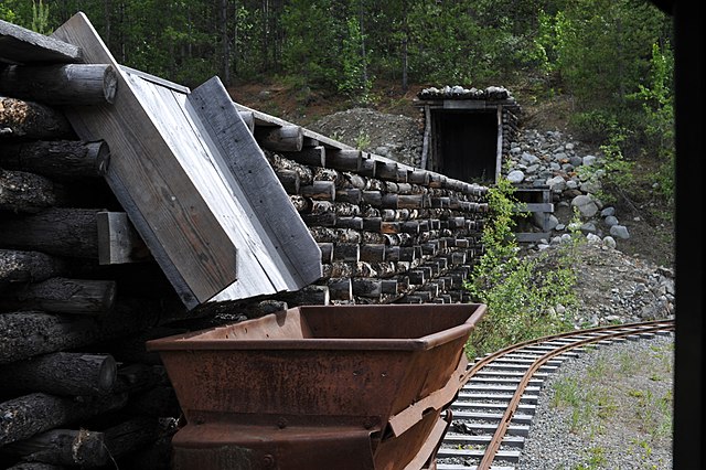
Ore is extracted from the mine tunnel and moved across the pier where it is dumped down the hopper into a waiting cart. The pier is constructed of crossed logs and tailings. QUS_2069 |
| Date | |
| Source | Hopper and Cart |
| Author | Chris Hunkeler from Carlsbad, California, USA |
| Camera location |
|
View this and other nearby images on: OpenStreetMap |
|
|---|
.jpg¶ms=060.743155_N_-135.133448_E_globe:Earth_type:camera_source:Flickr_&language=en)
Licensing
This file is licensed under the
Creative Commons
Attribution-Share Alike 2.0 Generic
license.
-
You are free:
- to share – to copy, distribute and transmit the work
- to remix – to adapt the work
-
Under the following conditions:
- attribution – You must give appropriate credit, provide a link to the license, and indicate if changes were made. You may do so in any reasonable manner, but not in any way that suggests the licensor endorses you or your use.
- share alike – If you remix, transform, or build upon the material, you must distribute your contributions under the same or compatible license as the original.
|
|
This image was originally posted to Flickr by Chris Hunkeler at https://flickr.com/photos/14913305@N00/15671202387 ( archive ). It was reviewed on 19 November 2017 by FlickreviewR 2 and was confirmed to be licensed under the terms of the cc-by-sa-2.0. |