Hurricane_Charley_13_aug_2004_1635Z.jpg

Size of this preview:
450 × 600 pixels
.
Other resolutions:
180 × 240 pixels
|
360 × 480 pixels
|
576 × 768 pixels
|
768 × 1,024 pixels
|
1,536 × 2,048 pixels
|
4,800 × 6,400 pixels
.
Summary
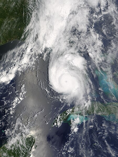
| Description | The MODIS sensor aboard NASA's Terra satellite captured this true-color image of Hurricane Charley on August 13 at 12:35 p.m. EDT. At the time this image was taken Charley was rapidly gaining strength and would reach category 4 status just 90 minutes later. Maximum sustained winds at 2:00 p.m. were at 145 mph and Charley was moving towards the north-northeast at 20 mph. | |||||
| Date | ||||||
| Source | http://earthobservatory.nasa.gov/NaturalHazards/natural_hazards_v2.php3?img_id=12331 | |||||
| Author | Image courtesy of the Space Science and Engineering Center, University of Wisconsin-Madison. | |||||
|
Permission
( Reusing this file ) |
|
|||||
| Other versions | Image:Hurricane Charley 2004.jpg |
