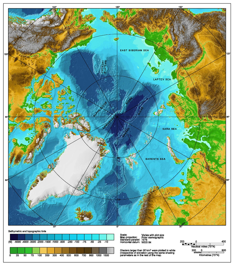
IBCAO_betamap.jpg
Size of this preview:
526 × 599 pixels
.
Other resolutions:
211 × 240 pixels
|
421 × 480 pixels
|
762 × 868 pixels
.
| Description |
Bathymetric map of the
Arctic Ocean
|
|||||||||
| Source | http://www.ngdc.noaa.gov/mgg/image/IBCAO_betamap.jpg | |||||||||
|
Permission
( Reusing this file ) |
|
|||||||||
| Geotemporal data | ||||||||||
| Bounding box |
|
|||||||||
| Georeferencing | ||||||||||
| Other versions |
Derivative works of this file: |
|||||||||