India-map-en.svg

Size of this PNG preview of this SVG file:
514 × 600 pixels
.
Other resolutions:
206 × 240 pixels
|
411 × 480 pixels
|
658 × 768 pixels
|
877 × 1,024 pixels
|
1,755 × 2,048 pixels
|
1,519 × 1,773 pixels
.
Ok ther are not anyone
Summary
| Description |
English
:
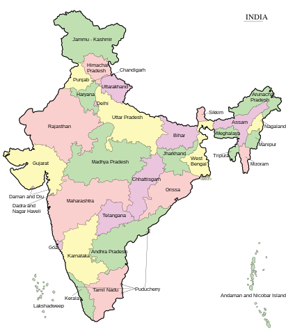
Map of India - states and union territories marked
मराठी
:
भारताचा नकाशा
हिन्दी
:
भारत का मानचित्र - राज्य और केंद्रशासित प्रदेश चिह्नित हैं
বাংলা
:
ভারত দেশের মানচিত্র
ਪੰਜਾਬੀ
:
ਭਾਰਤ ਦਾ ਨਕਸ਼ਾ
ગુજરાતી
:
ભારતનો નકશો : રાજ્ય અને કેન્દ્રશાસિત પ્રદેશો
ଓଡ଼ିଆ
:
ଭାରତ
ମାନଚିତ୍ର
தமிழ்
:
இந்தியாவின் வரைபடம் - மாநிலங்கள் மற்றும் யூனியன் பிரதேசங்கள் குறிக்கப்பட்டுள்ளன
ಕನ್ನಡ
:
ಭಾರತದ ಭೂಪಟ
മലയാളം
:
ഇന്ത്യയുടെ ഭൂപടം - സംസ്ഥാനങ്ങളും കേന്ദ്രഭരണപ്രദേശങ്ങളും അടയാളപ്പെടുത്തിയിരിക്കുന്നു
اردو
:
بھارت کا نقشہ
|
||
| Date | |||
| Source | Transferred from ml.wikipedia to Commons. | ||
| Author | Rajeshodayanchal at Malayalam Wikipedia . | ||
| Other versions |
[
]
|


|
This SVG file contains embedded text that can be translated into your language, using any capable SVG editor, text editor or the SVG Translate tool . For more information see: About translating SVG files . |
Licensing
|
|
This media file is uploaded with
Malayalam loves Wikimedia event
.
|
Rajeshodayanchal
at
Malayalam Wikipedia
, the copyright holder of this work, hereby publishes it under the following license:
This file is licensed under the
Creative Commons
Attribution-Share Alike 3.0 Unported
license.
Attribution:
Rajeshodayanchal
at
Malayalam Wikipedia
-
You are free:
- to share – to copy, distribute and transmit the work
- to remix – to adapt the work
-
Under the following conditions:
- attribution – You must give appropriate credit, provide a link to the license, and indicate if changes were made. You may do so in any reasonable manner, but not in any way that suggests the licensor endorses you or your use.
- share alike – If you remix, transform, or build upon the material, you must distribute your contributions under the same or compatible license as the original.
Original upload log
This file was originally uploaded at ml.wikipedia as India-map-en.svg , before it was transfered to Commons.
Upload date | User | Bytes | Dimensions | Comment
- 4/10/2011 10:29:58 AM | Rajeshodayanchal | 277070 (bytes) | 1519×1773 | വിട്ടുപോയ കേന്ദ്രഭരണപ്രദേശങ്ങൾ കൂട്ടിച്ചേർക്കുന്നു
- 4/10/2011 2:28:09 AM | Rajeshodayanchal | 254531 (bytes) | 1519×1773 | {{വിവരങ്ങൾ |വിവരണം = ഇന്ത്യയുടെ ഭൂപടം - സംസ്ഥാനങ്ങളും കേന്ദ്രഭരണപ്രദേശങ്ങളും അടയാളപ്പെടുത്തി�