Intracoastal_Waterway_Louisiana.jpg

Size of this preview:
800 × 533 pixels
.
Other resolutions:
320 × 213 pixels
|
640 × 427 pixels
|
1,024 × 683 pixels
|
1,500 × 1,000 pixels
.
| Description |
English:
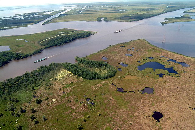
Navigation on the Gulf Intracoastal Waterway (GIWW), where it intersects with Bayou Perot in Louisiana, USA. The view in this picture is to the south. The GIWW runs left–right across the picture. The bayou comes in from the left and enters Lake Salvador on the right. The bayou is the boundary between Jefferson Parish in the foreground and Lafourche Parish in the distance beyond the bayou.
|
|||
| Date | ||||
| Source |
U.S. Army Corps of Engineers Digital Visual Library
Image page Image description page Digital Visual Library home page |
|||
| Author | Lane Lefort, U.S. Army Corps of Engineers | |||
|
Permission
( Reusing this file ) |
|
|||
| Location | New Orleans, Louisiana, USA |
| Camera location |
|
View this and other nearby images on: OpenStreetMap |
|
|---|