IranaftertheIlkhanate.png
Size of this preview:
800 × 452 pixels
.
Other resolutions:
320 × 181 pixels
|
640 × 362 pixels
|
1,200 × 678 pixels
.

|
This
historical map
image could be re-created
using
vector graphics
as an
SVG
file
. This has several advantages; see
Commons:Media for cleanup
for more information. If an SVG form of this image is available, please upload it and afterwards replace this template with
{{

vector version available

|

new image name

}}
.
It is recommended to name the SVG file “IranaftertheIlkhanate.svg”—then the template Vector version available (or Vva ) does not need the new image name parameter. |
| Description |
English:
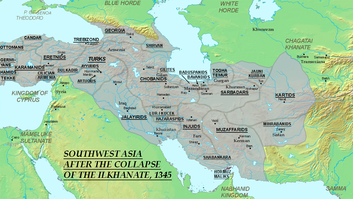
Map showing the political situation in southwest Asia in 1345, ten years after the death of Abu Sa'id. The Jalayirids, Chobanids, Muzaffarids, Injuids, Sarbadars and Kartids took the Ilkhanate's place as the major powers in Iran.
|
||||||||
| Date | 12 June 2007 (original upload date) | ||||||||
| Source | Originally from en.wikipedia ; description page is/was here . | ||||||||
| Author | Original uploader and author was Ro4444 at en.wikipedia | ||||||||
|
Permission
( Reusing this file ) |
Ro4444
at the
English-language Wikipedia
, the copyright holder of this work, hereby publishes it under the following license:
|
