IsraelCVFRchart-BorderNorth_copy.jpg

Size of this preview:
442 × 599 pixels
.
Other resolutions:
177 × 240 pixels
|
354 × 480 pixels
|
567 × 768 pixels
|
756 × 1,024 pixels
|
1,308 × 1,772 pixels
.
| Description |
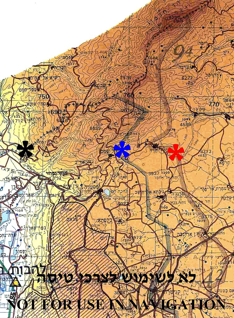
English:
Borders between Israel, Syria and Lebanon in
Mount Hermon
region
The (+++) line between Israel and Lebanon – marked by black asterisk Disengagement Israeli front line with Syria (1974) - marked by blue asterisk Disengagement Syrian front line with Israel (1974) - marked by red asterisk. |
||
| Date | |||
| Source | Aeronautical Information Publication - Domestic (AIP) of the Israel Civil Aviation Administration – presently Civil Aviation Authority (CAA) | ||
| Author | Etan Tal | ||
|
Permission
( Reusing this file ) |
|
Image to be used for illustration of aviation articles. Not for actual navigation. Original image is public domain (State Regulations) - uploader added the disclaimers prohibiting navigation use in compliance with normal aviation practice. Modified image released to the public domain as well.