JanMayen.jpg
No higher resolution available.
Summary
| Description |
Deutsch:
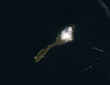
Satellitenfoto der Jan Mayen-Insel
English:
Satellite picture of Jan Mayen Island, Greenland Sea
Español:
Foto satélite de Jan Mayen
Suomi:
Jan Mayen satelliittikuvassa
Čeština:
Satelitní snímek ostrova Jan Mayen. Přibližné souřadnice: 70°58′59″ s. š., 8°30′00″
|
| Date | |
| Source | http://rapidfire.sci.gsfc.nasa.gov/gallery/?2004243-0830/JanMayen.A2004243.1225.250m.jpg |
| Author | Image courtesy of MODIS Rapid Response Project at NASA/GSFC |
|
Permission
( Reusing this file ) |
http://lancedev.eosdis.nasa.gov/tools/rapid-response/about-imagery/ |
| Other versions | Image:JanMayen_angepasst.jpg |
Licensing
|
|
This file is in the public domain in the United States because it was solely created by NASA . NASA copyright policy states that "NASA material is not protected by copyright unless noted ". (See Template:PD-USGov , NASA copyright policy page or JPL Image Use Policy .) |
|

|
Warnings:
|