Johnston_Atoll_satellite_map.jpg

Size of this preview:
800 × 600 pixels
.
Other resolutions:
320 × 240 pixels
|
640 × 480 pixels
|
1,024 × 768 pixels
|
1,280 × 960 pixels
|
1,600 × 1,200 pixels
.
Summary
| Description |
English:
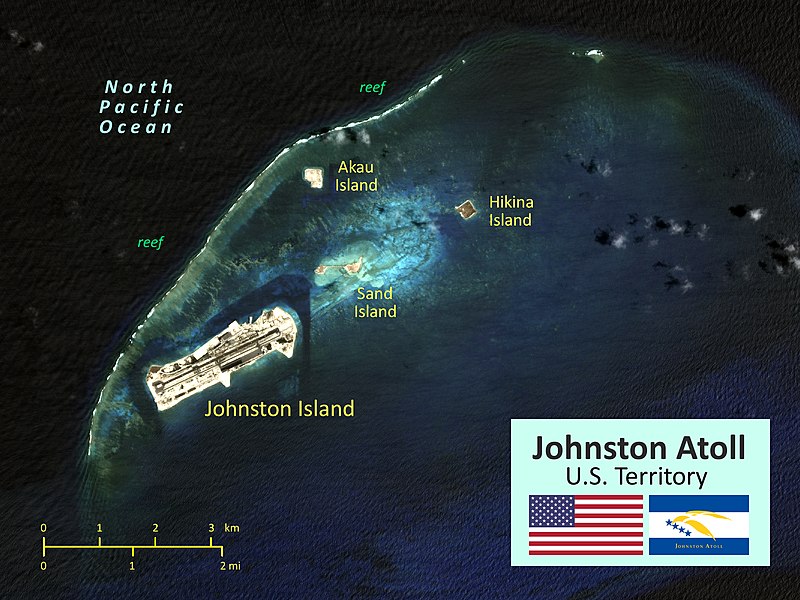
Satellite map of Johnston Atoll (Kalama Atoll), U.S. Territory in the North Pacific Ocean.
|
| Date | |
| Source | NASA satellite image modified for mapping |
| Author |
National Aeronautics and Space Administration Wikipedia User: Surfsupusa |
| Camera location |
|
View this and other nearby images on: OpenStreetMap |
|
|---|
Licensing
|
|
This file is in the public domain in the United States because it was solely created by NASA . NASA copyright policy states that "NASA material is not protected by copyright unless noted ". (See Template:PD-USGov , NASA copyright policy page or JPL Image Use Policy .) |
|

|
Warnings:
|