Kaart_Hanzesteden_en_handelsroutes.jpg
Size of this preview:
800 × 440 pixels
.
Other resolutions:
320 × 176 pixels
|
640 × 352 pixels
|
1,176 × 647 pixels
.
Summary
| Description |
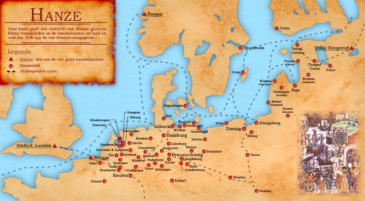
English:
Dutch map of the different small and large Hanseatic Leage cities and trade routes.
Nederlands:
Nederlandstalige kaart van de verschillende grote en kleine Hanzesteden en de handelsroutes. Hierop ontbreekt Oldenzaal.
|
| Date | |
| Source | eigen werk (own work) + Base map from: File:Europein1328.png by Afterword |
| Author | Doc Brown |
Licensing
I, the copyright holder of this work, hereby publish it under the following licenses:

|
Permission is granted to copy, distribute and/or modify this document under the terms of the GNU Free Documentation License , Version 1.2 or any later version published by the Free Software Foundation ; with no Invariant Sections, no Front-Cover Texts, and no Back-Cover Texts. A copy of the license is included in the section entitled GNU Free Documentation License . |
This file is licensed under the
Creative Commons
Attribution-Share Alike
3.0 Unported
,
2.5 Generic
,
2.0 Generic
and
1.0 Generic
license.
-
You are free:
- to share – to copy, distribute and transmit the work
- to remix – to adapt the work
-
Under the following conditions:
- attribution – You must give appropriate credit, provide a link to the license, and indicate if changes were made. You may do so in any reasonable manner, but not in any way that suggests the licensor endorses you or your use.
- share alike – If you remix, transform, or build upon the material, you must distribute your contributions under the same or compatible license as the original.
You may select the license of your choice.