KangnidoMap.jpg
No higher resolution available.
Summary
| Title |
English:
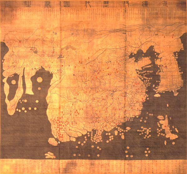
Kangnido
한국어:
혼일강리역대국도지도
|
|||||||||
| Description |
English:
Kangnido map
(1402). The later Honkōji version of the map is available here:
GeneralMapOfDistancesAndHistoricCapitals.jpg
at a higher resolution.
한국어:
혼일강리역대국도지도.
|
|||||||||
| Date | ||||||||||
| Source | ... | |||||||||
| Creator |
Kim Sahyung, Lee Moo, Lee Hui
|
|||||||||
| Geotemporal data | ||||||||||
| Date depicted | ||||||||||
| Bounding box |
|
|||||||||
| Georeferencing | ||||||||||
| Bibliographic data | ||||||||||
| Language | Hanja | |||||||||
Licensing
|
This is a faithful photographic reproduction of a two-dimensional,
public domain
work of art. The work of art itself is in the public domain for the following reason:
The official position taken by the Wikimedia Foundation is that "
faithful reproductions of two-dimensional public domain works of art are public domain
".
This photographic reproduction is therefore also considered to be in the public domain in the United States. In other jurisdictions, re-use of this content may be restricted; see Reuse of PD-Art photographs for details. |
||||