Karte_Hoch_und_Niederburgund_EN.png

Size of this preview:
564 × 600 pixels
.
Other resolutions:
226 × 240 pixels
|
452 × 480 pixels
|
722 × 768 pixels
|
963 × 1,024 pixels
|
2,000 × 2,126 pixels
.
Summary
| Description |
English:
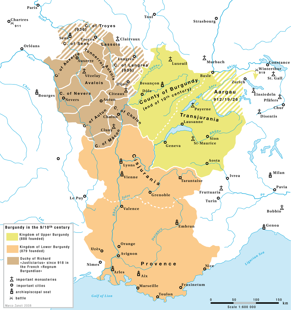
Burgundy in the 9th and 10th century: The kingdoms of Upper-Burgundy, Lower-Burgundy and the Duchy of Richard the Justiciar in the French part of the old Burgundian Kindom.
|
| Date | |
| Source | Own work |
| Author | Marco Zanoli ( Sidonius ) |
| Other versions |
|


Licensing
|
You may use my work outside wikipedia for free as long as you name me as the author. If you would like to use my work in a print medium, please send me a specimen copy.
Contact me if you have questions regarding the license or if you want individual changes to the map (marco.zanoli at hotmail.ch).
This file is licensed under the
Creative Commons
Attribution-Share Alike 4.0 International
license.
Attribution:
Marco Zanoli
|